

Welcome to a new edition of ‘Last Week in Earth Observation’, containing a summary of major developments in EO from the last week and some exclusive analysis and insights from TerraWatch.
Four Curated Things
Major developments in EO from the past week
💰 Contractual Stuff: Funding, Contracts and Deals
M&A
- Space logistics firm D-Orbit acquired Italian EO solution provider Planetek to build an integrated offering for onboard processing services.
My take: D-Orbit has been a quiet player in the edge computing space, offering its platform as an infrastructure for testing EO-based edge processing applications, including with Planetek in the past. This move shows that D-Orbit is doubling down on the EO market segment.
Contracts
- Planet signed a multi-year expansion contract with onX, a digital navigation firm that builds outdoor recreation apps.
🗞️ Interesting Stuff: More News
- Iceye launched a hurricane data impact solution designed to provide insurers with near-instant visibility into wind and flood damage across the US;
- Array Labs announced plans for its 3D imaging satellite constellation;
- Early results from ESA's Arctic Weather Satellite mission is positive, showing that small satellite missions can be effective for operational weather forecasts.
🔗 Click-Worthy Stuff: Check These Out
- This piece from an executive at AXA on the importance of geospatial AI for the insurance sector;
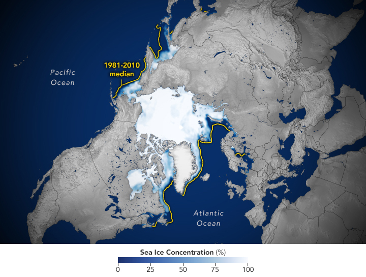
- This article and this one from NASA on how the Arctic and Antarctic sea ice levels have been at record lows since satellite observations began.
One Discussion Point
Exclusive analysis and insights from TerraWatch
Earth Observation for Wildfire Monitoring
Wildfires have existed for as long as plant life has existed on Earth. Not all fires are destructive—wildfires help clear nutrients in the soil and open access to sunlight while killing certain problematic insects and diseases. Some tree and plant species even depend on the heat from a fire to open up their seeds. This is why fire experts and land managers set fires to existing ecosystems under specified weather conditions to restore health to ecosystems that depend on the fire.
But when they get out of control, wildfires can become dangerous - costing the US economy between $394 billion and $893 billion annually, beyond immediate wildfire damage, including impacts to real estate value, premature deaths, and health risks from wildfire smoke, threats to watersheds; and income loss.
Wildfires develop where there is available combustible vegetation and an ignition source, such as from lightning strikes or human activity, accidental or intentional. While roughly four out of five wildfires are started by people (varies by country), dry weather, droughts, and strong winds - all impacted by climate change - transform a spark of fire into wildfires consuming tens of thousands of acres.
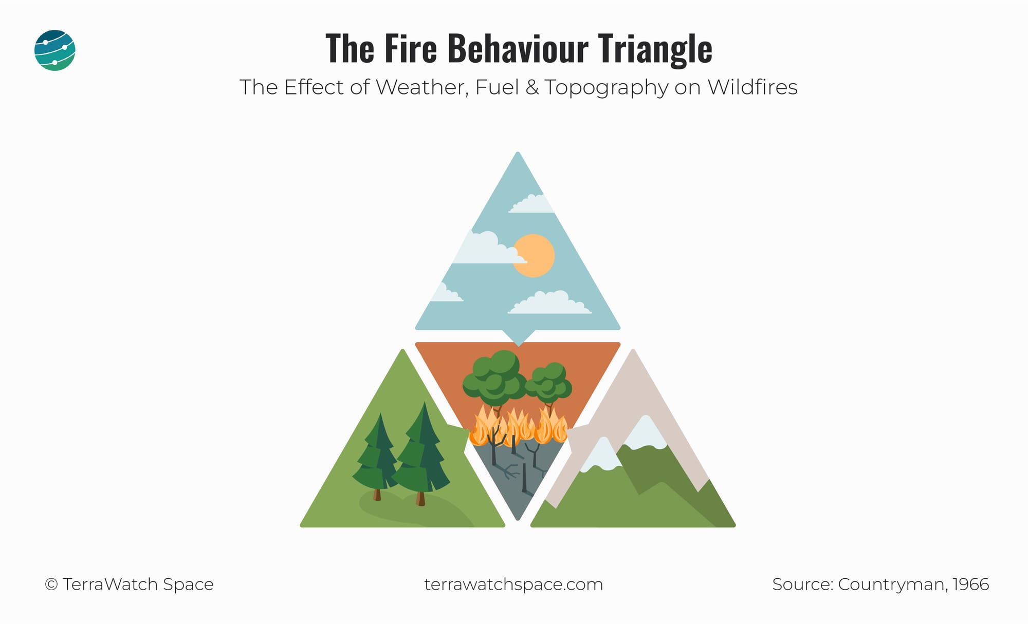
The Fire Behaviour Triangle
Wildfires represent a complex, multiscale problem—a confluence of biological, meteorological, physical, and social factors influencing their likelihood, behaviour, duration, extent, and outcome. As a result, the observational infrastructure also requires a multimodal solution, from connected sensors and cameras on the ground to satellites in multiple orbits.
But what do we really observe when we use EO to monitor wildfires?
The "fire behaviour triangle" provides a framework for identifying the key variables that affect how a wildfire behaves.
Fuel is anything that burns, including both live and dead vegetation, from plants and trees to leaves and saplings. Weather indicators and topographic conditions affect how fast fires spread.
These three variables determine a fire's behaviour - speed, direction, and flame characteristics and intensity, which can be classified into 14 indicators.
Check out the full deep dive to learn more about these indicators, how satellites are used to track them, and the market for EO for wildfire monitoring.
Scene from Space
One visual leveraging EO
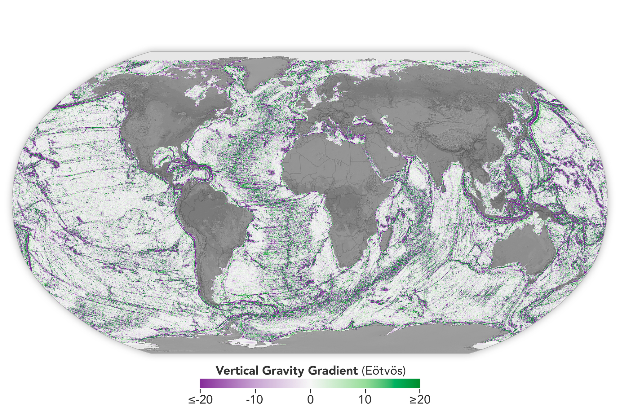
Mapping the Seafloors from Space
It is a bit insane for me how there are better maps of the Moon’s surface than of the bottom of Earth’s ocean. However, thanks to data from NASA's SWOT mission, researchers have been working on building accurate maps of the ocean floor. These have both commercial applications (navigation and underwater communications cables) and scientific applications (deep-sea currents, tides and geology).
Until next time,
Aravind.


