

Welcome to a new edition of ‘Last Week in Earth Observation’, containing a summary of major developments in EO from the last week and some exclusive analysis and insights from TerraWatch.
Four Curated Things
Major developments in EO from the past week
1. Contractual Stuff: Funding, Contracts and Deals 💰
Contracts
- Spire won a contract worth $1M from the Government of Canada to provide automatic identification system ship tracking data;
- Swedish satellite manufacturer AAC Clyde Space signed a contract with the Scottish government to offer data from its planned satellite constellation;
- Israel Aerospace Industries won a contract worth over $1B from Morocco to build and launch two EO reconnaissance satellites to replace the Airbus-built Mohammed VI-A and Mohammed VI-B currently in orbit;
- The US Air Force awarded weather intelligence firm Tomorrow.io a contract of $10.2M for two weather satellites with microwave sounders;
- The US Space Force awarded General Atomics a contract for an additional weather satellite as part of the Electro-Optical Weather System.
2. Strategic Stuff: Partnerships and Announcements 📈
Partnerships
- Iceye signed an MoU with the Ukrainian Ministry of Defense ensuring that the imagery captured over Ukraine will not be shared with hostile countries;
- EarthDaily Analytics is entering into a strategic partnership with South Korean geospatial intelligence firm Indyware;
- German defense firm Helsing is teaming up with Loft Orbital to test onboard radio frequency signal detection using data from Loft’s YAM-6 satellite;
Announcements
Maxar announced the availability of Vivid Advanced, its satellite imagery basemap with a 15cm resolution in urban areas around the world;
KaleidEO, the subsidiary of Indian EO firm SatSure plans to launch four edge computing-enabled multispectral imaging satellites in 2026.
For more on edge computing in EO, check out the exclusive deep dive.
3. Interesting Stuff: More News 🗞️
- The US military plans to award a $3 billion contract for AI-driven intelligence, which includes data and analytics from EO satellites;
- According to the Copernicus Climate Change Service, the average global temperature has been 1.5°C above the pre-industrial era for 12 consecutive months, with the hottest June on record;
- SpaceX’s Falcon 9 vehicle suffered upper-stage engine failure, which can lead to potential delays in the launch of many EO satellites, especially those waiting to launch on the Transporter-11 mission among others.
4. Click-Worthy Stuff: Check These Out 🔗
- This paper that proposes an adaptive, deep meta-learning model to enable the processing of satellite images with diverse resolutions;
- This article from NASA on how satellites contribute to wildlife management;
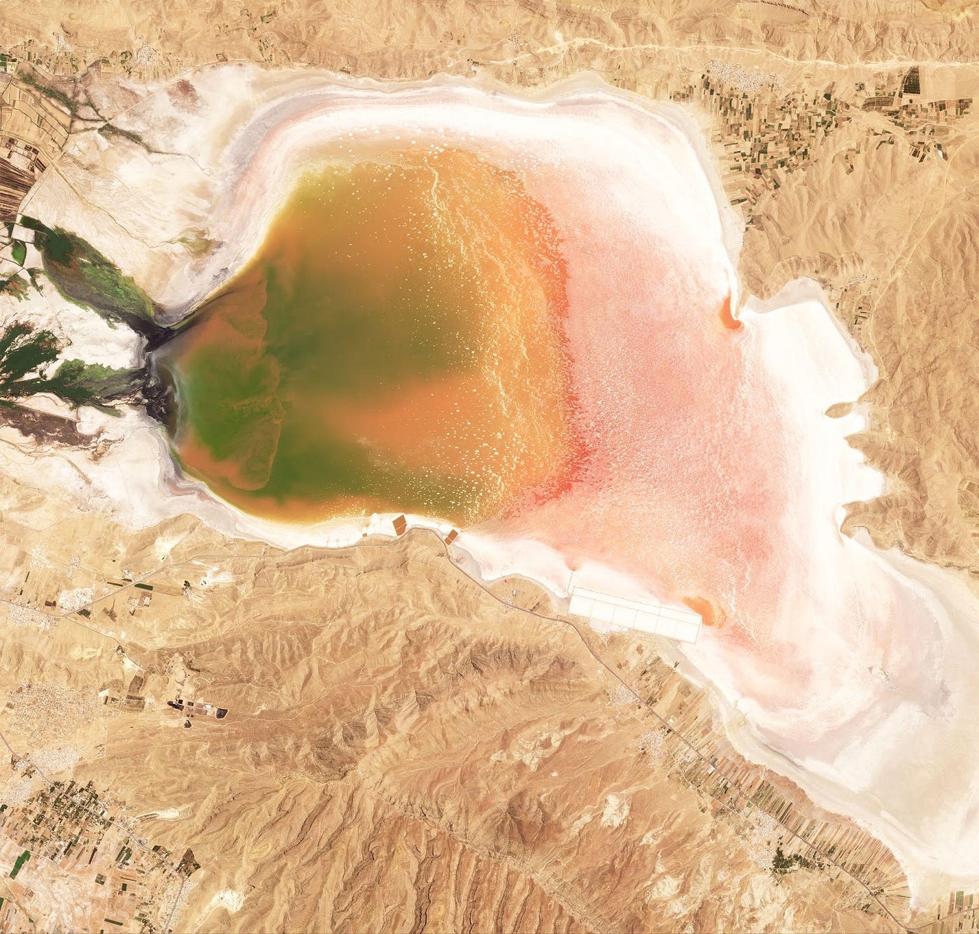
- This edition of Planet’s weekly newsletter with some gorgeous images of the lakes on our planet.
This is a reader-supported publication. To receive exclusive deep dives and support my work, consider becoming a paid subscriber.
One Discussion Point
Exclusive analysis and insights from TerraWatch
5. AI for Weather Forecasting
There is a silent revolution going on in the weather world powered by AI. European Centre for Medium-Range Weather Forecasts has introduced the Artificial Intelligence Forecasting System (AIFS), a data-driven ensemble weather forecasting model, similar to those developed by Google, Huawei & NVIDIA. So, what's the big deal about this one? First, some basics.
Context
Weather forecasting models can be classified into two: deterministic and ensemble.
Deterministic models
Deterministic models provide a single forecast based on a given set of initial conditions of the atmosphere, for a specific location and time - essentially the 'best forecast' within the laws of physics. These are great for short-to-medium-term forecasts (7 days).
While deterministic models can be really accurate due to the potential for high-resolution forecasts in the best-case scenario, they can also be way off especially due to the range of possible states of the atmosphere and the uncertainties associated with 'guessing' them. Enter ensemble models!
Ensemble models
Ensembles run many simulations accounting for all the uncertainty in the initial conditions of the atmosphere and, hence provide several possible results. These are great for medium-to-long-term forecasts (up to 2 weeks) esp. by comparing the results.
Ensemble models (like the AIFS by ECMWF) are inherently probabilistic - if 90% of the results predict heavy rain, there is high confidence in the forecast. Similarly, even if only 10% of the results predict a storm, it can facilitate early warning systems and support disaster management.
Why ECMWF’s AIFS is significant?
AI and weather forecasting are truly a match made in the atmosphere. With a given set of data and boundary conditions, the AI model is capable of generating hundreds to thousands of simulations which can help us forecast that disaster, that we may have missed before. This is important especially for climate adaptation plans, given the rise in frequency and/or intensity of natural disasters. I am excited about the possibility of having better early warning systems in the global south, which suffers more due to the lack of weather infrastructure, which is slowly being filled with more weather satellites.
In addition, seeing a public-sector organisation keep up with the private sector advancements and continuously innovate is great. This is fundamentally important as I believe weather is a public good (free/open) and should always be.
Finally, it is amazing that the model and its source code will be open-source. This means that anyone in the weather community can use the AIFS model and identify strengths and weaknesses so that the forecasts become better.
— — —
For more on the state of weather satellites, check out this free deep-dive from a couple of years back. I have been wondering if this piece needs an update, especially with a new section on AI for weather. What do you think?
Scene from Space
One visual leveraging EO
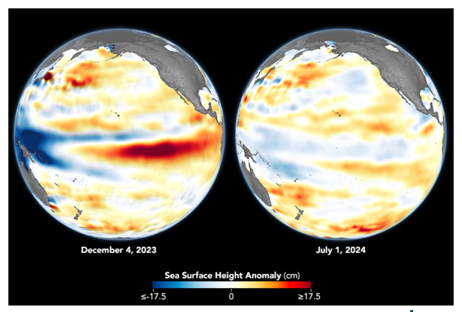
6. The End of El Niño
According to NASA, the El Niño phenomenon came to an end in May 2024, as shown through the normalisation of sea surface height across the central and eastern Pacific Ocean, comparing the El Niño phase (December) and neutral phase (July). This phenomenon contributed to record ocean temperatures. These ocean topography measurements were from the Sentinel-6 Michael Freilich, a US-Europe partnership mission, launched in 2021.
Until next time,
Aravind.


