

Welcome to a new edition of ‘Last Week in Earth Observation’, containing a summary of major developments in EO from the last week and some exclusive analysis and insights from TerraWatch.
Four Curated Things
Major developments in EO from the past week
💰 Contractual Stuff: Funding, Contracts and Deals
- BlackSky won a multimillion dollar contract with a new international defense customer to provide imagery and analytics services;
- Planet signed a multi-year contract expansion with the Colombian mapping agency to offer its platform and change detection service;
- Quantum computing firm completed its acquisition of Capella Space with goals to develop the world’s first space-based quantum key distribution network;
- Geospatial mapping firm Felt raised $15M in funding to integrate AI into spatial data workflows.
📈 Strategic Stuff: Partnerships and Announcements
- Bloomberg Terminal has integrated analytics from EarthDaily into its platform for providing agriculture-related commodities;
- Fugro has teamed up with Esri to provide integrated geospatial solutions focused on climate resilience;
- Planet has released some sample data from its hyperspectral imaging satellites with a Creative Commons license.
While this move might seem obvious for satellite-based hyperspectral imagery, especially to develop the nascent ecosystem and data processing libraries, the fact that companies have taken on the Creative Commons (CC-BY 4.0) licensing approach, pioneered by Umbra - even if selectively - is encouraging. There is a long road ahead in terms of licensing practices, data accessibility, and consistency, but I’m cautiously excited to see momentum building.
🗞️ Interesting Stuff: More News
- New research released by the UK Space Agency shows that satellite services accounts for about 18% of national GDP, with £264B for meteorological satellites and £164B for EO;
- NASA announced that the agency will not publish any scientific climate-related assessments on its website.
🔗 Click-Worthy Stuff: Check These Out
- My keynote presentation slides on the state of EO platforms delivered as part of a session at ESA's Living Planet Symposium last month;
- Titled, "The State of Earth Observation Platforms: Towards Data Fusion, AI-Readiness and Vertical Specialization," I discussed the evolution of EO platforms, key trends in data management, access, and processing, impact of AI across the value chain and more. (for informational purposes only, not to reuse).
- This article that shows how satellite imagery was used to refute a company’s claims in an appeal case;
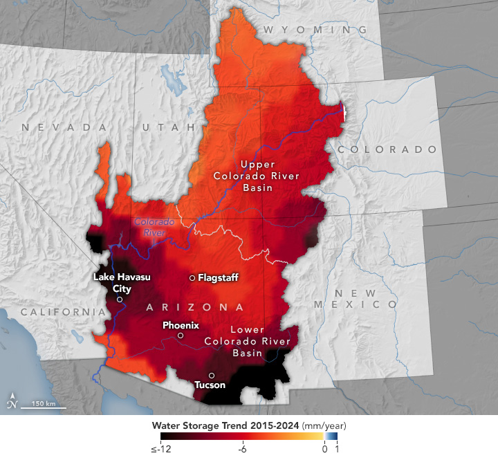
- This article showing how researchers reported rapid and accelerating losses of groundwater in Arizona using gravitational data from the GRACE mission.
One Discussion Point
Exclusive analysis and insights from TerraWatch
EO for Carbon Markets
Satellites are fundamental to understanding the carbon cycle - from monitoring the carbon dioxide emissions that escape to the atmosphere to estimating the level of carbon stored in the natural environment (trees, soil, marine ecosystems). Called carbon flux, satellites are a crucial part of the system that tracks the direction and rate of flow of carbon between the oceans the atmosphere, the land, and other living things.
To simplify the role of satellites in monitoring and observing the carbon cycle, the elements of observation can be classified into three: blue carbon, forest carbon and soil carbon.
The figure below shows the three categories of carbon that can be monitored and estimated using satellite data, along with examples of what they represent. Note that the figure does not attempt to demonstrate the carbon cycle in itself, but rather lists aspects of the carbon cycle that can be monitored using EO.
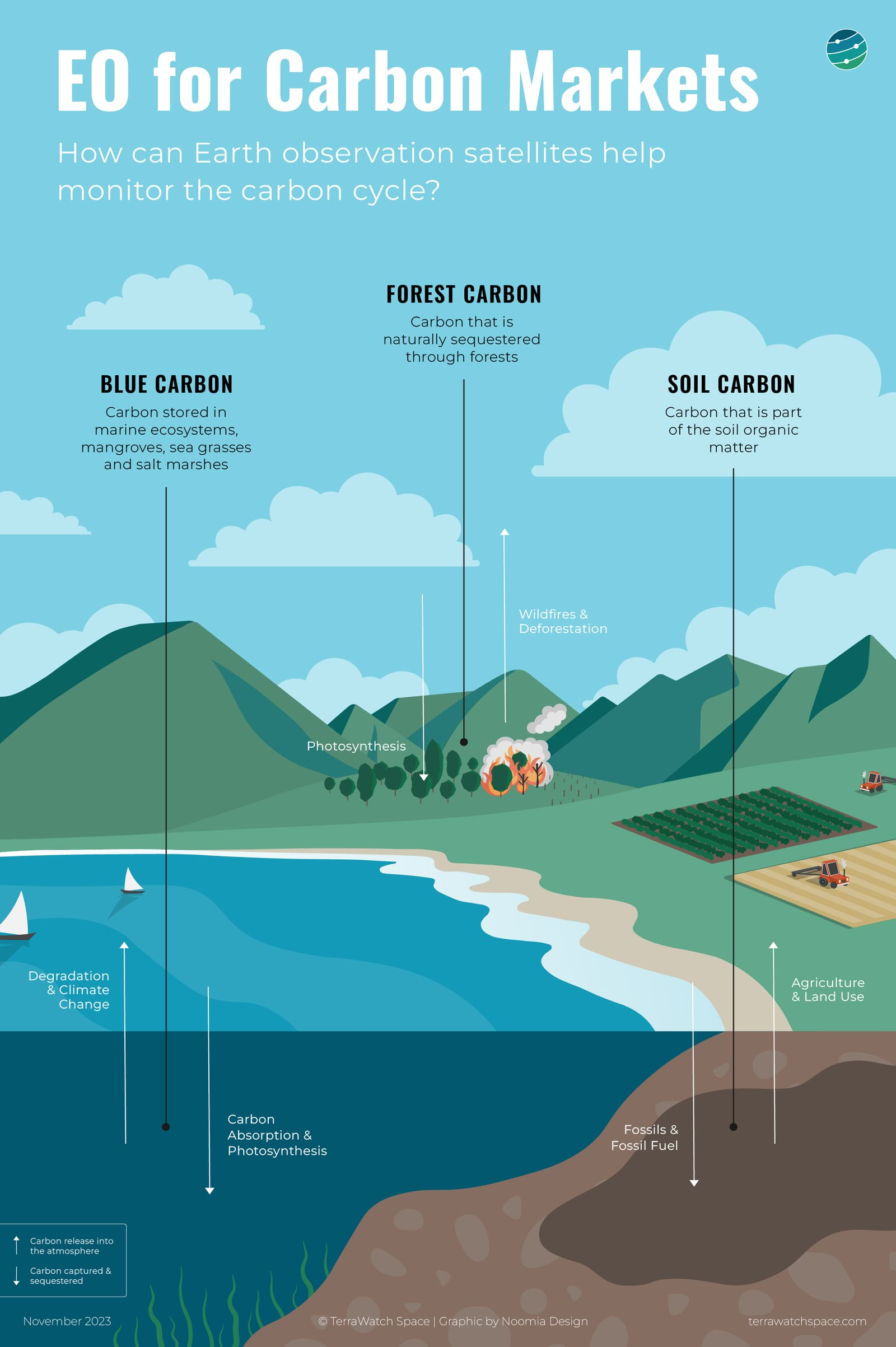
EO and Carbon Monitoring
The decline in the growth of voluntary carbon markets amid contiuning scrutiny raises a larger question of whether this market will continue to grow and exist in its current form, over the coming years. While carbon projects related to agriculture and soil carbon might be less prone to greenwashing and junk credits, especially compared to forest carbon projects, the overall negative connotations associated with carbon offsets would require time to shave off.
From a technical perspective, however, the need for EO is not under threat. Satellites are the most objective and scalable mode of remote sensing technology, considering the global nature of carbon projects. While the need and willingness to pay for commercial EO data is still under validation, given that several open EO data sources exist that get the job done, the need for continuous monitoring and higher resolution solutions will continue to grow, especially if the carbon markets recover and demand rises.
Become a paid subscriber to read the full piece which includes a deep dive on the role of EO in the voluntary carbon market, the importance of EO in making carbon markets work and the overall commercial landscape.
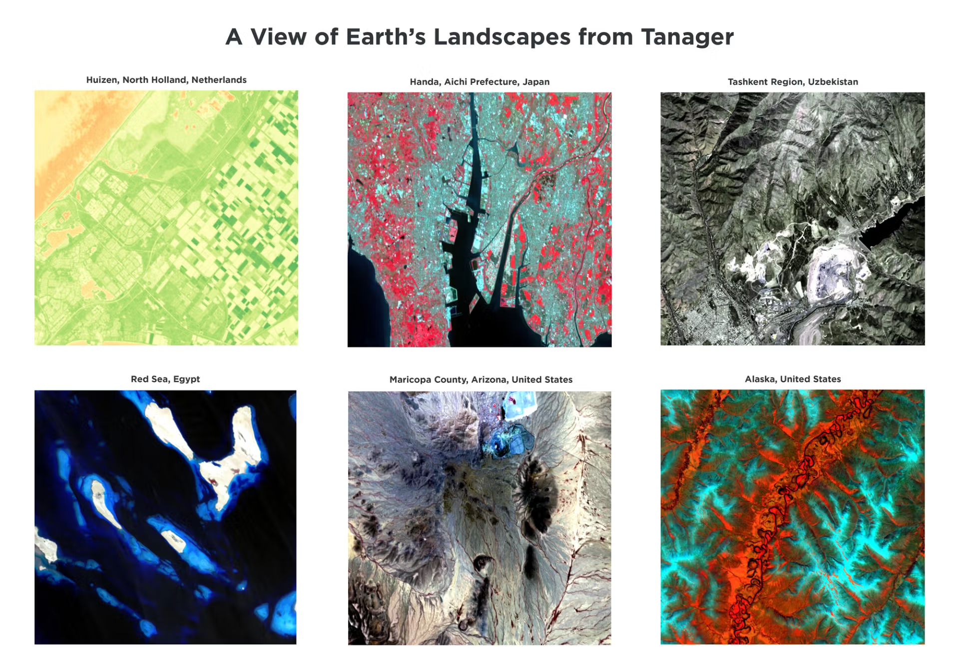
Scene from Space
One visual leveraging EO
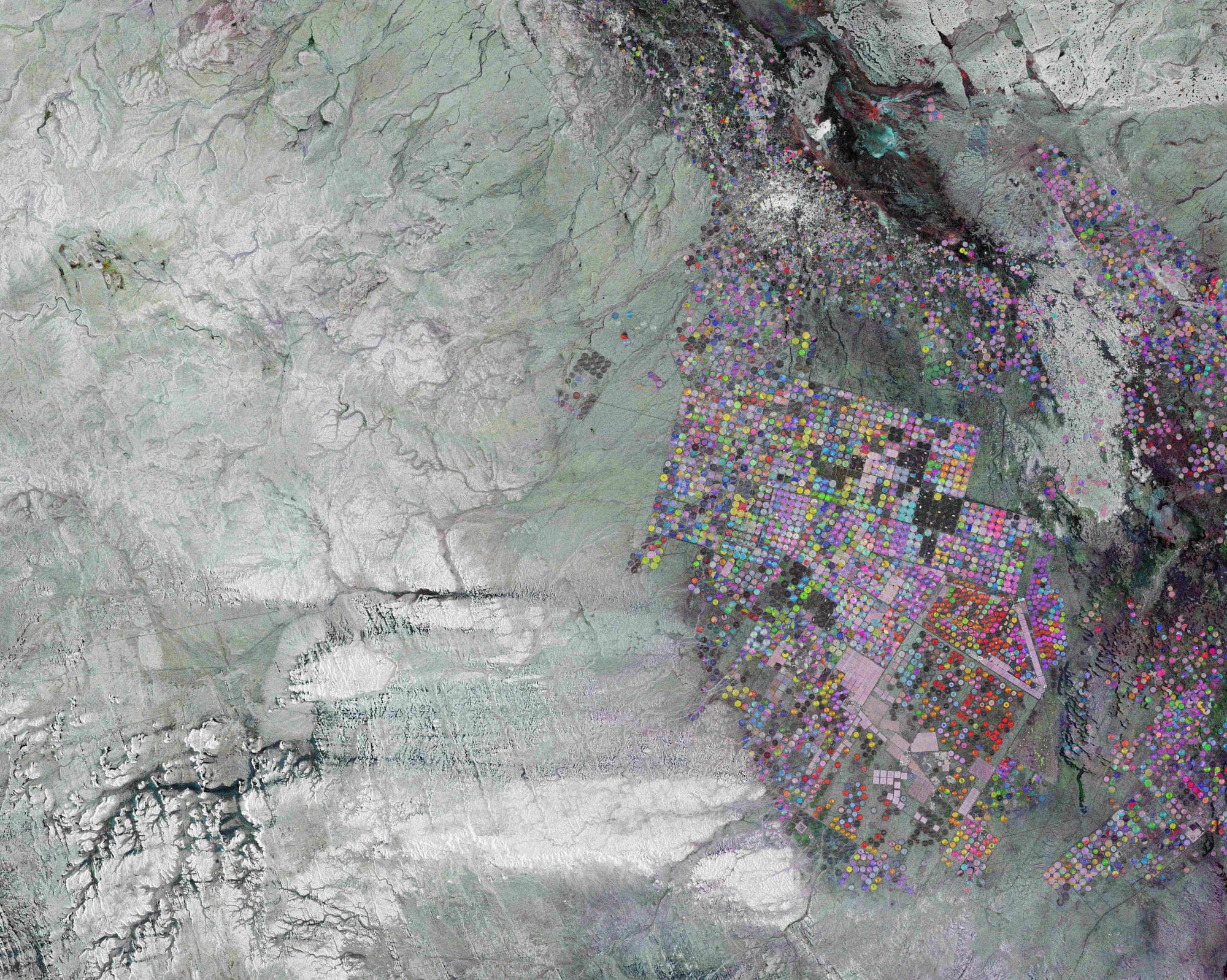
Observing Agriculture in The Desert
This image from ESA showing a Sentinel-1 image of northern Saudi Arabia showing how a desert region is used for agriculture using central-pivot irrigation systems. The circles, each approximately one kilometre wide, consist of a well at the centre of each circle, which supplies water from underground aquifers to rotating sprinklers.
Until next time,
Aravind.


