

Welcome to a new edition of ‘Last Week in Earth Observation’, containing a summary of major developments in EO from the last week and some exclusive analysis and insights from TerraWatch.
📢 Quick Note
As I’ve hinted before, the weekly free edition of the TerraWatch newsletter will be going away from September – this is the one of the last regular editions!
In its place, a new paid tier with weekly briefings and deeper insights is launching soon.
Free editions will be less frequent but with a refreshed format and new content.
Watch out for the announcement email on August 1!
Four Curated Things
Major developments in EO from the past week
💰 Contractual Stuff: Funding, Contracts and Deals
- Thermal infrared data provider Hydrosat won a contract from National Reconnaissance Office.
📈 Strategic Stuff: Partnerships and Announcements
- Spire announced the launch of new radio frequency intelligence products targeting the defense and security sectors;
- Tomorrow io announced that its microwave sounder satellites deliver higher accuracy in temperature sensing and significant improvements in humidity measurements compared to NASA’s TROPICS satellites;
🗞️ Interesting Stuff: More News
- Airbus' CO3D constellation, aimed at providing global high-resolution digital surface model and CNES' MicroCarb satellite, that focuses on mapping CO2 emissions, launched last week;
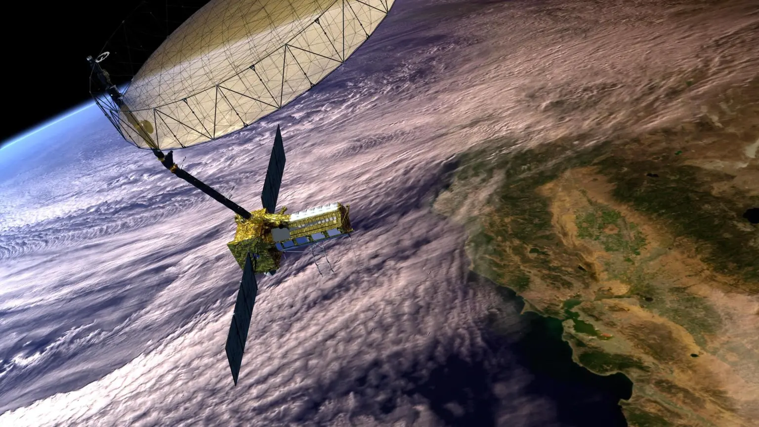
- NISAR, an EO satellite with L-band and S-band SAR instruments, built by ISRO and NASA, will launch later this week.
What is NISAR? A radar satellite bringing together two frequencies (L- and S-band), enabling improved observation of land, sea and ice.
What are the applications? Tracking coastal erosion, mapping floods, measuring glacier movements, detecting landslides, monitoring soil moisture, estimating forest biomass and more.
Why does it matter? NISAR will complement Sentinel-1 by providing consistent, open SAR data that strengthens global monitoring, especially in underserved regions.
🔗 Click-Worthy Stuff: Check These Out
- This paper on using EO for implementing the EU regulation on deforestation-free products;
- This article on the progress made using satellite imagery for methane monitoring and mitigation;
- This article on how NASA is using onboard processing for smarter EO;
Related: The TerraWatch deep dive on edge computing for EO.
One Discussion Point
Exclusive analysis and insights from TerraWatch
The TerraWatch EO Value Chain
Below is how the EO value chain is defined at TerraWatch. While this will continue to evolve, as the market evolves, you will see this framework used in most analysis published by us.
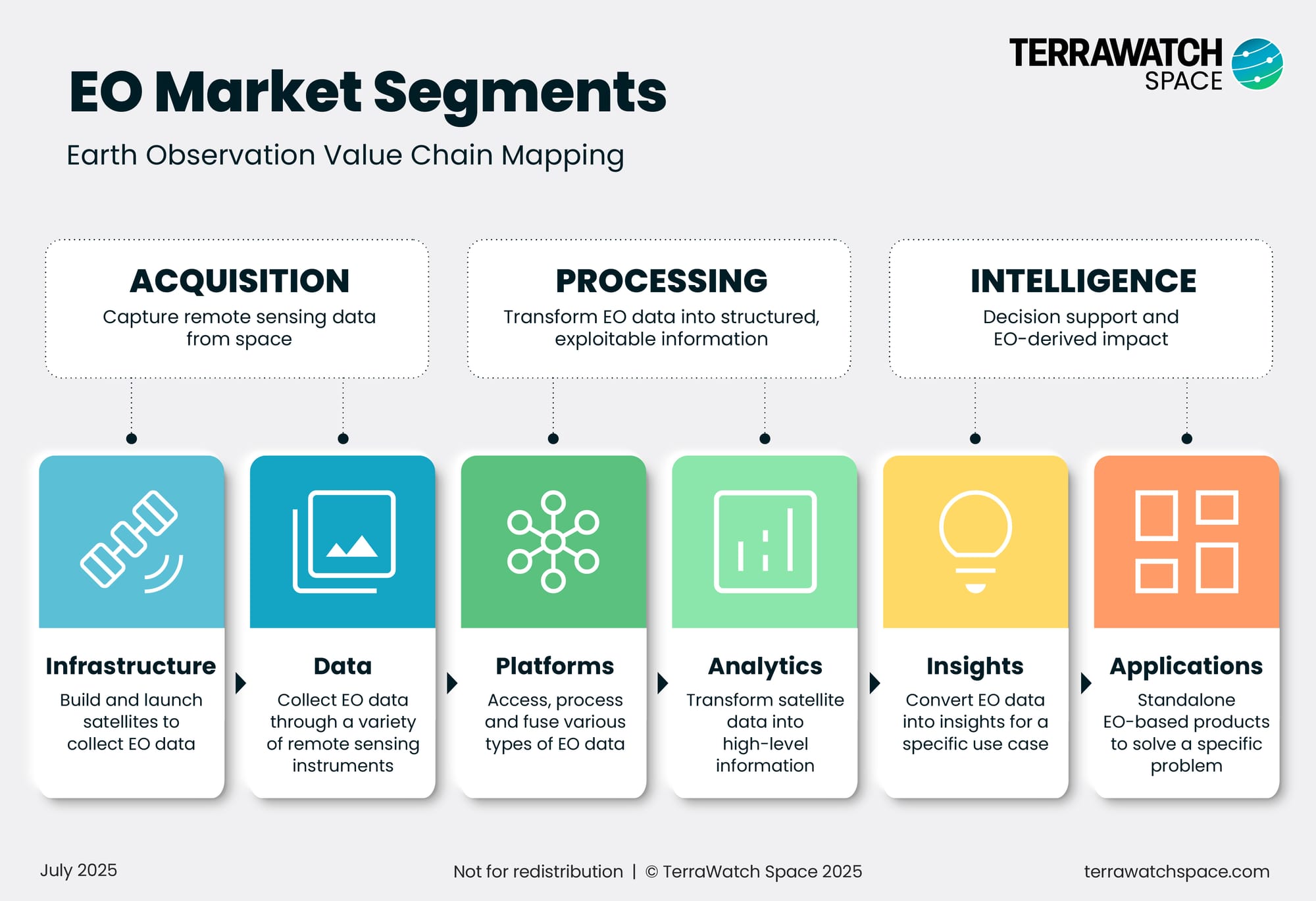
The EO value chain is structured across three broad categories – Acquisition, Processing and Intelligence – which are further broken down in to six core segments, as described below.
To bring this value chain to life, I have included a wildfire monitoring example that follows how EO data flows from satellite to application.
Infrastructure: Includes companies that build the satellites predominantly meant to launch EO instruments.
Example: A satellite equipped with a thermal infrared sensor is launched specifically to monitor wildfires.
Data: Refers to the collection and delivery of EO data from satellites through various remote sensing instruments.
Example: An EO provider delivers wildfire imagery (e.g., 30m resolution, twice daily) under a subscription or per-scene model.
Platforms: Platforms allow users to access, process, and integrate EO data from multiple sources via APIs and preprocessing workflows.
Example: An EO expert uses a geospatial platform to fuse datasets and run standard workflows for wildfire risk analysis.
Analytics: This segment transforms raw satellite data into structured, high-level information.
Example: An EO expert derives key wildfire indicators such as vegetation growth, soil moisture, and surface temperature, from EO data.
Insights: Involves converting EO data into useful insights by aggregating and interpreting the previously derived analytics to support specific decisions.
Example: A wildfire mitigation specialist at a utility firm models fire progression using EO-derived indicators, provides 3-day forecasts on a dashboard, and triggers early warning alerts to operations teams.
Applications: Standalone tools that use EO among other sources of data to solve concrete problems in a specific domain.
Example: A wildfire management platform that triggers grid shutdowns, firefighter deployment, or insurance workflows based on EO alerts.
Scene from Space
One visual leveraging EO
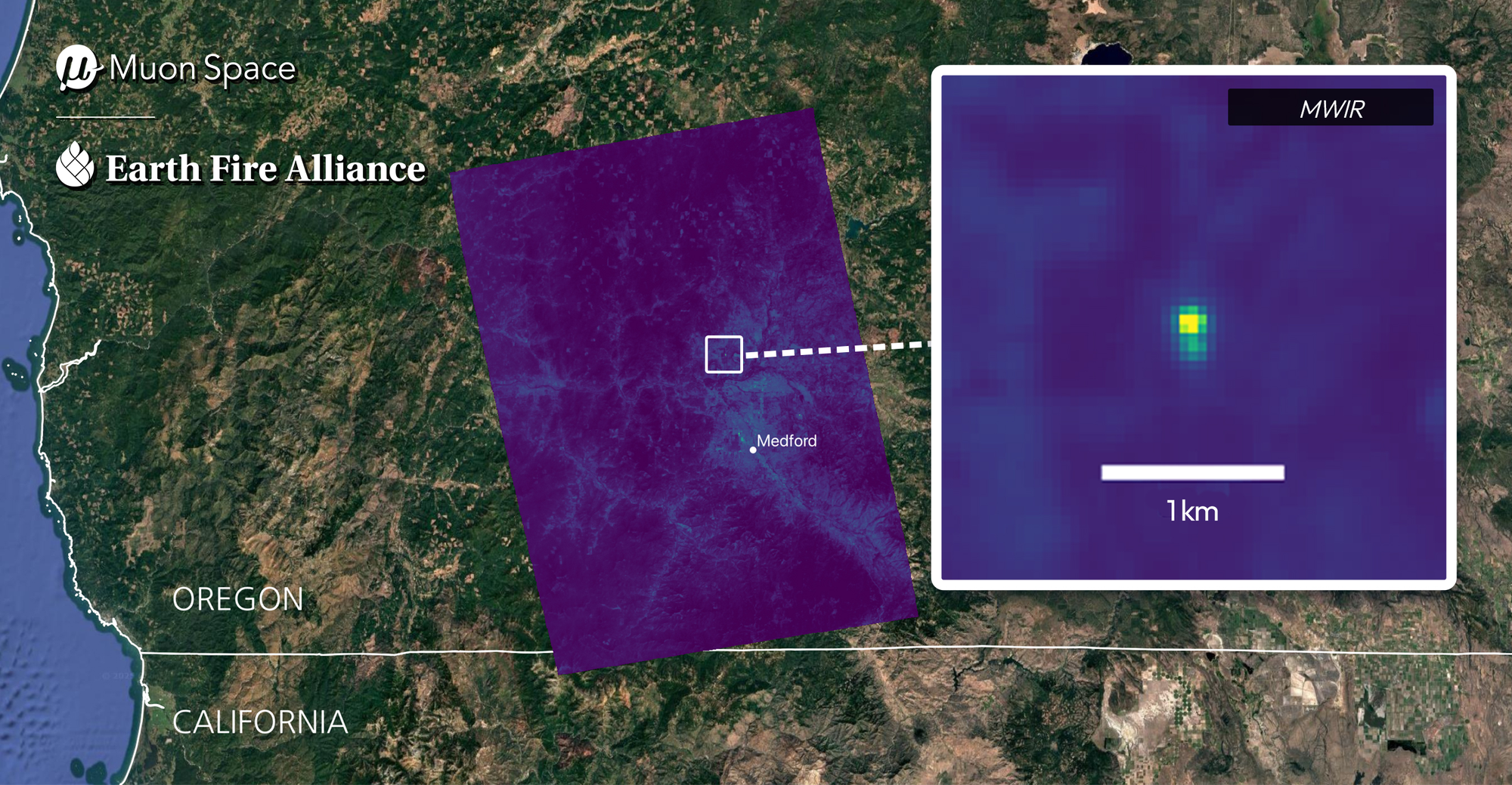
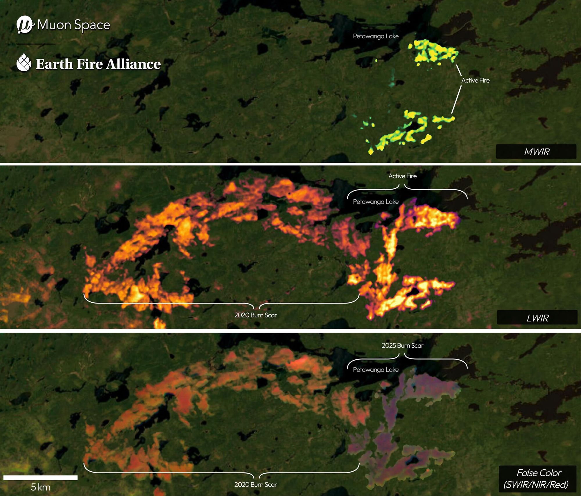
FireSat - First Images
Earth Fire Alliance, in collaboration with Muon Space and Google Research, released the first images from the FireSat Protoflight satellite. FireSat can detect fires as small as 5x5 meters, making it orders of magnitude more precise than existing satellites.
Below are two images showing (top) a small roadside fire in Oregon, USA on June 23, 2025, that was, according to the organisation, not detected by other space-based systems and (bottom) active fire regions in Ontario, Canada as bright spots and burn scars in false-colour.
Until next time,
Aravind.


