

Welcome to a new edition of ‘Last Week in Earth Observation’, containing a summary of major developments in EO from the last week and some exclusive analysis and insights from TerraWatch.
If this was forwarded, subscribe for free to get your copy every week. Already a free subscriber? Then, become a paid subscriber and get exclusive EO insights.
Four Curated Things
Major developments in EO from the past week
1. Contractual Stuff: Funding, Contracts and Deals 💰
Funding
South African camera manufacturer Simera Sense which provides payloads for EO missions has raised almost $15M in funding;
Orbio Earth, a startup building a satellite-based methane monitoring solution for energy firms has raised $4M in seed funding;
Lumen Orbit, which plans to launch a constellation of satellites for in-orbit computing has raised $2.4M in pre-seed funding;
For more, check out TerraWatch’s deep-dive on edge computing ($)
Contracts
- Thales Alenia Space won a €7M contract from ESA to build SAR instruments for the Harmony mission aimed at monitoring the Earth’s surface and ocean;
- EO-based infrastructure monitoring firm Asterra was awarded a multi-year contract with AEGEA, a sanitation company in Brazil to monitor water leaks.
2. Strategic Stuff: Partnerships and Announcements 📈
Partnerships
- Array Labs, which plans to collect 3D imagery from space has entered into a strategic partnership with hyperspectral imaging firm Esper Satellite Imagery in an attempt to create a fused dataset;
- Planet, which announced an upgrade to its crop biomass data product, is partnering with agriculture market leader Bayer to build sustainable agriculture solutions;
- SAR data provider e-GEOS announced the signing of a reseller agreement with Umbra.
3. Interesting Stuff: More News 🗞️
NASA is revamping a major series of EO satellite missions, delaying some and relying more on international partners for others to reduce costs;
Related: My analysis on why this is not good news for the future of EO and how to think about solving this challenge;
The U.S. Army has extended a contract with Maxar Intelligence for 3D terrain models used to create immersive training environments for soldiers;
Rocket Lab launched a SAR satellite for Japanese EO firm Synspective, marking its fourth bird in orbit;
A recent report from the International Energy Agency showed that the US energy industry methane emissions are triple the official figures.
4. Click-Worthy Stuff: Check These Out 🔗
This paper that discusses how data from a pair of L-band SAR satellites (Argentina’s SAOCOM) was used to measure the height of trees;
This article that explains how geostationary weather satellites can now be also used for monitoring methane emissions every five minutes;
For more on EO for GHG monitoring, check out TerraWatch’s deep-dive ($)
This piece that shows how sensors on animals are used to complement satellite observations for monitoring wildlife ecology and the environment.

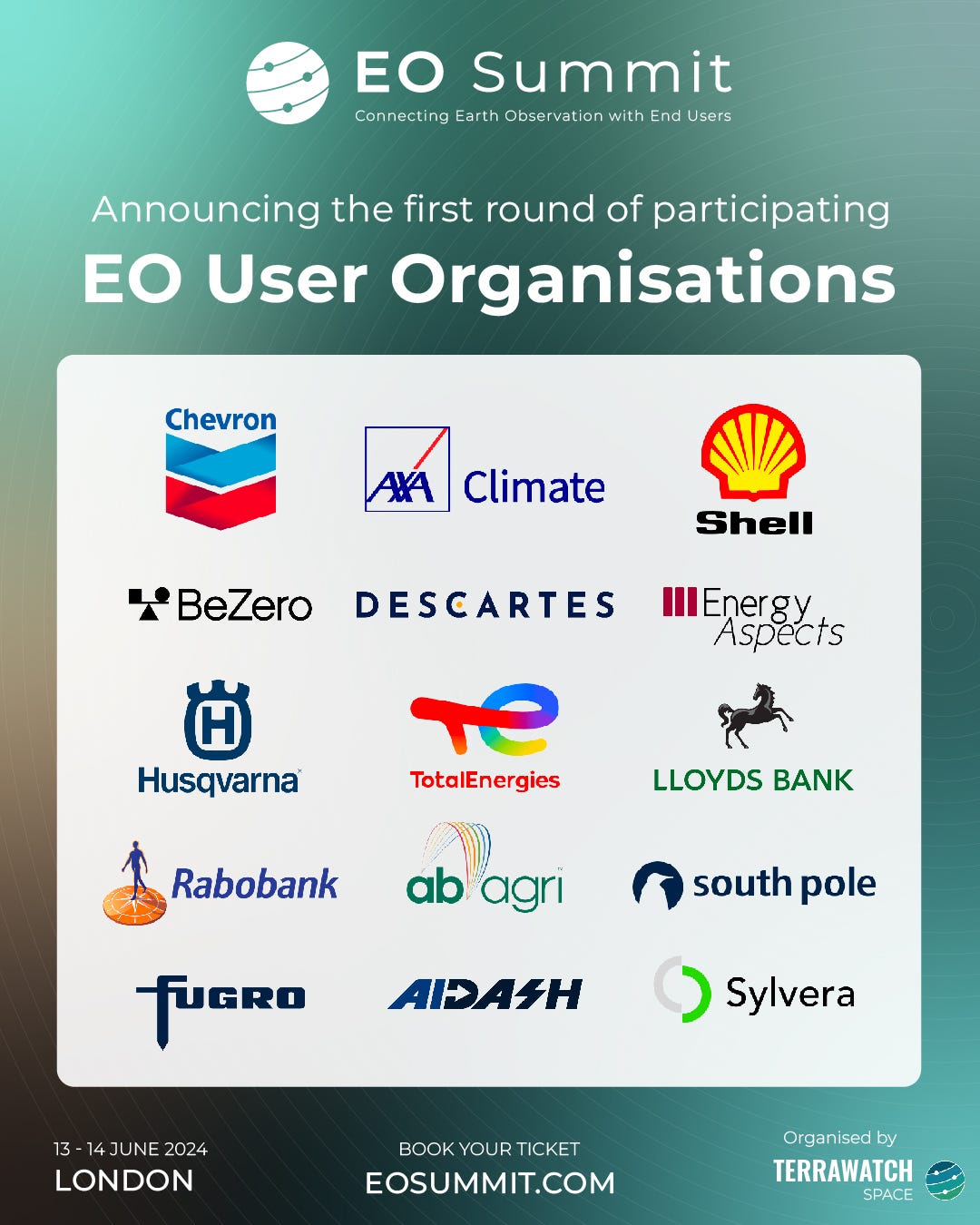
EO Summit: Announcing Some of the Participating EO User Organisations
Here are some of the EO end user and intermediary user organisations that will be participating at EO Summit. My sole motivation for organising an event is to bring the EO user community so that we as an industry can hear about their use cases, how they are using EO, and their challenges in adopting EO.
So, it gives me great pleasure to announce that some of the largest end-user organisations are participating in the first edition of EO Summit.
This is only the first round, more to come!
Early-Bird Tickets: Last Day
The (extended) early-bird ticket sale will end tomorrow, March 19. Benefit from the low price, EUR 249 per ticket and reserve your place now!
One EO Discussion Point
Exclusive analysis and insights from TerraWatch
5. EO for Climate Risk
Last week we mentioned that US regulators have approved climate disclosure rules that will require large companies to disclose physical climate risks to their assets. But, what are climate risks and how is EO relevant for that?
Quick Primer on Climate Risk
The risks associated with climate change are typically divided into two categories: physical and transition risks. Even though they are categorised into two groups, all the climate-driven risks are interconnected. The earlier we take action (i.e. reduce our dependence on fossil fuels and protect biodiversity) managing the transition risks, the more manageable the physical risks might be. The longer we wait, the worse both risks become for everyone. An overview of the risks that are particularly relevant to EO, is given in the figure below, followed by a brief description of the two categories.
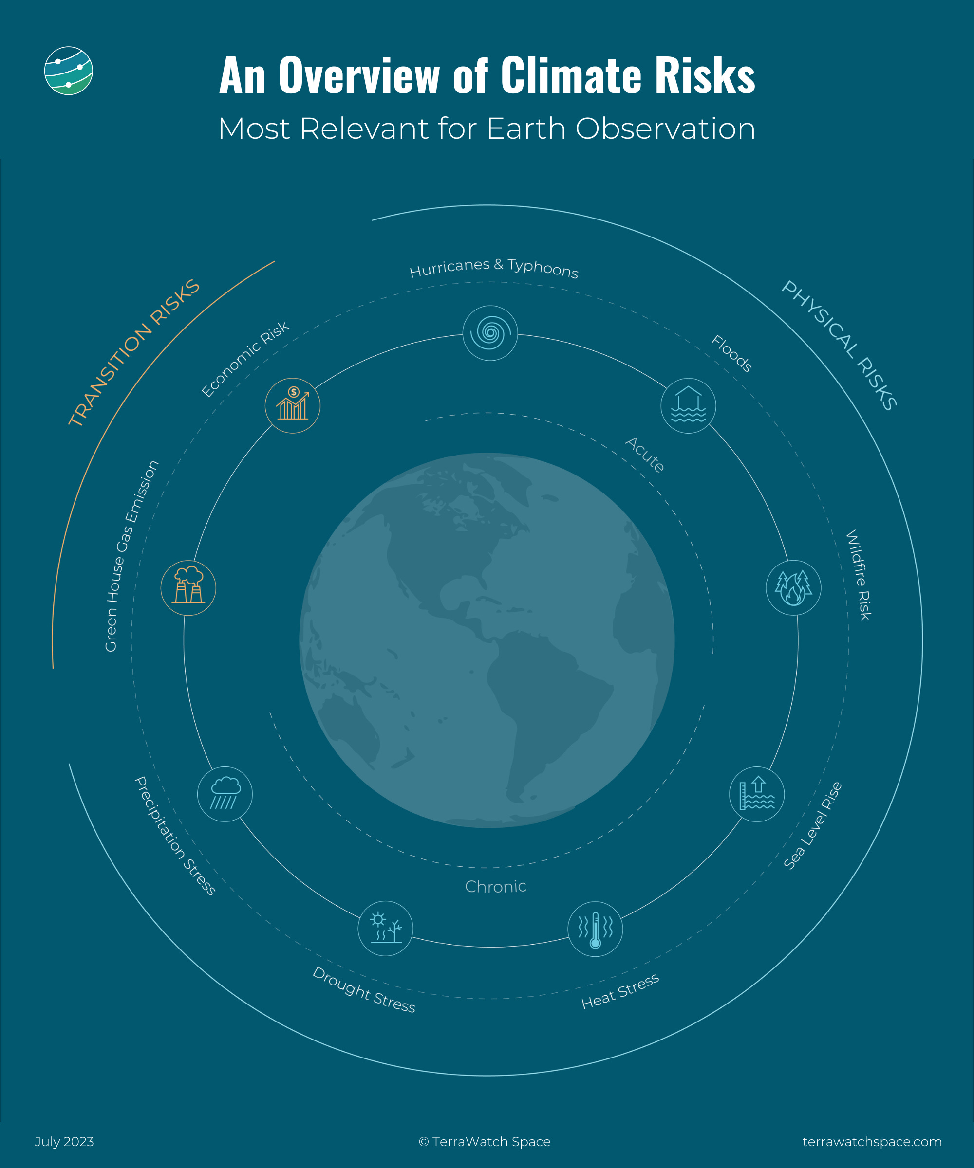
EO and Climate Risk
Scan through the risks mentioned in the figure and you are somewhat familiar with the applications of Earth observation satellites. Their unique role in the monitoring of long-term climate risks should be pretty clear.
Data acquired from the different types of sensors provide crucial information for most of the climate risks. Satellites launched by governmental agencies have been collecting data about the state of the planet and our activities on it for more than five decades. That coupled with data from emerging commercial satellites and a variety of other sensors (drones, aerial, balloons, weather stations and other ground sensors) play a distinct role in understanding climate risk, serving as inputs to the climate models around the world.
Become a paid subscriber to read the full piece which includes an introduction to climate risk, the types of risks, the importance of EO, an overview of the landscape for measuring, reporting and responding to climate risks and some examples of climate risk in use.
Scene from Space
One visual leveraging EO
6. A New Indian Weather Satellite
The Indian space agency ISRO launched the INSAT-3DS weather satellite (Indian National Satellite System-3D Second Repeat), part of the third-generation series of meteorological satellites. The satellite includes a 6-channel multispectral imager for clouds and land monitoring, a 19-channel atmospheric sounder to measure temperature and humidity, and a search and rescue transponder to support disaster management operations.
Along with INSAT-3D and INSAT-3DR, INSAT-3DS is India’s third geostationary weather satellite in orbit, contributing to weather forecasting and early warning systems for several South Asian countries.
Following the launch last month, ISRO released the first images captured by the satellite. I wanted to share this image this week as we generally don’t come across many satellite images of Asia from geostationary satellites.
ICYMI: I shared a post on social media last weekend about how weather forecasting has gotten so much better in the past few decades, but there is some serious weather inequality in the world. Lot of work to do!

Until next time,
Aravind


