UP42, a Germany-based startup, is an Earth observation (EO) platform and marketplace that allows users to access and process Earth observation data from different providers, enabling them to build and scale their applications.
Overstory, a startup based in the Netherlands, which just completed its Series A funding round, offers a vegetation monitoring platform for electric utility companies to prevent power outages and devastating fires caused by vegetation growing or falling into electric power lines.
Overstory leverages UP42’s platform to get access to archived satellite imagery, from various sensors, acquired by different commercial providers as well as to task satellites to capture the imagery of a needed area of interest, all based on a transparent pricing model. This enables Overstory to easily process and integrate the insights from EO directly into their products.
Given the crucial role that UP42 plays in enabling the underlying technology behind Overstory’s vegetation monitoring product, the two organisations also recently extended their partnership.
This article will delve deeper into why EO applications need multiple data sources, the challenges of accessing them and how UP42 enables organisations like Overstory to identify the sweet spot between price, availability, resolution, and delivery speed, becoming a fundamental enabler of their technology stack.
Earth Observation Applications from Multiple Data Sources
Applications developed using Earth observation (EO) data generally depend on more than one data source. Data can be acquired from multiple sensors in orbit from different EO data providers as well as from other sources such as stratospheric balloons, aircraft, drones and ground sensors. As such, the final solution that provides actionable insights to the end-users is more often derived from a combination of different data sources as indicated in the figure below.
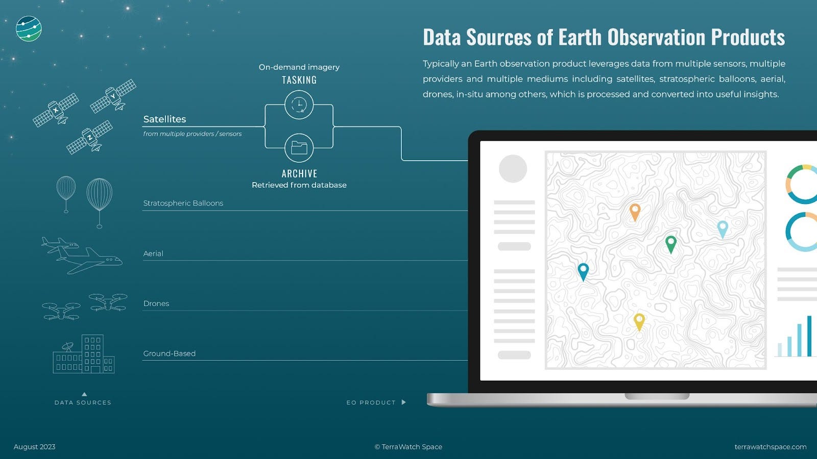
Depending on the use case, there are several reasons for depending on more than one data source. In the initial demonstration phase, where an application is being developed, historical satellite imagery, called archived data, might be required to conduct a time-series analysis of the area of interest. At this stage, training data for machine learning models might be required, whereas data from other sources such as balloons, aircraft and drones might also be required. Typically, this data is of higher spatial resolution and hence, helps improve the machine learning algorithm to identify objects and detect patterns.
As the application development progresses, more up-to-date data might be required for real-time monitoring of the area of interest. This is where on-demand imagery, called tasked data, becomes relevant allowing the application developer to capture an image or a series of images of the area of interest on a given date or specific timeframes in the future. This tasked data when fused with existing data points enables automated real-time monitoring through EO.
Accessing Multiple Sources of Satellite Data
There are several distributors of EO data, called EO marketplaces or EO platforms available in the market that facilitate the development of EO applications from different sources. However, any tool that allows access to multiple sources of EO data needs to make sure that some criteria are met, in order to ensure a proper user experience and value add for the application developers. The three important factors are accessibility, usability and affordability, as described below.
Accessibility
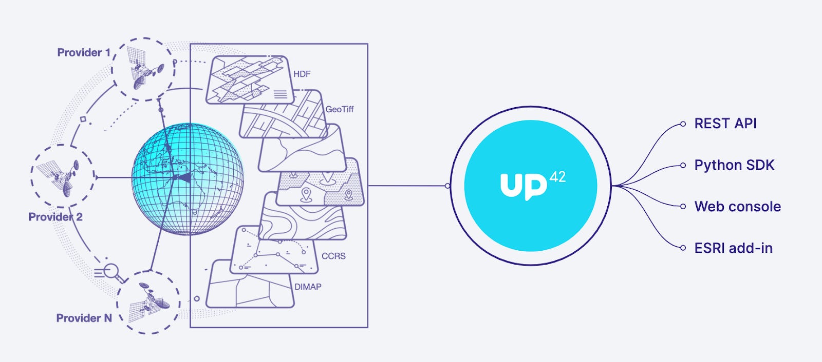
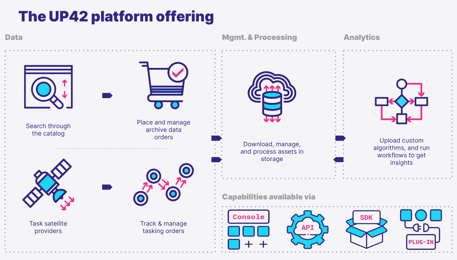
In order for EO application developers to have maximum flexibility in their development cycle, it is vital that as many data sources, both from satellites and other sources, are available through the same tool with a similar technical process. Therefore, it is necessary that the tool allows developers to access different data sources on the same platform through different mechanisms, whether it is through an application programming interface (API), via a software development kit (SDK), through a web interface or through other third-party applications.
Usability
Different EO data sources are available in different formats such as GeoTIFF, HDF, DIMAP etc. As such the platform that allows accessing various data sources needs also to ensure that the data being distributed is usable for the application developers, depending on their needs. Therefore, the platform should be able to provide usable EO data that satisfies the requirements of the developer and is delivered in the right format, at the desired timeframe and through the required distribution channel.
Affordability
The pricing models of EO data do not typically follow a standardised methodology. Depending on whether developers require archived satellite data, tasked satellite data or data from other sources, the models vary and it is generally difficult to forecast price points. Therefore, one of the most crucial factors for an EO platform is the ability to normalise the pricing model across data sources, data providers and data requirements.
UP42, a Germany-based startup, is an example of an EO platform that satisfies all the three criteria mentioned above, enabling application developers to access and process EO data from different providers, in different formats and via different distribution channels. Through its platform, UP42 works with several organisations to build fully automated, scalable and reliable solutions based on EO data.
The following section describes how UP42 supports Overstory in developing an EO-enabled application to fight utility outages.
How UP42 Enables Overstory to Fight Utility Outages
To train and update their AI model, Overstory needed continuous access to different types of satellite data with flexibility for iterative development of their vegetation monitoring solutions. As the company matured, Overstory increasingly required very high-resolution imagery to better train their AI model, providing them with the most optimal choice that is delivered at the right price, resolution, and delivery speed. In other words, Overstory was looking for a tool that would make EO data accessible, usable and affordable.
UP42’s platform provided Overstory with data from different providers, as both archived form and tasked data. As with any application, application development needs different types of data at different stages. While initially, Overstory was using more archived data, they have now shifted to using more real-time, high-resolution imagery that allows them to clearly identify individual plants and trees, and improve their machine learning models. They also access digital terrain models and digital surface models through UP42, which gives them valuable elevation data and height information about natural and man-made features.
The credit-based pricing model offered by UP42 allowed Overstory to forecast pricing costs for data, plan data collection in advance, and pivot or modify their operations if required. Leveraging multiple data sources from UP42, Overstory builds machine-learning models that support the development of their global vegetation monitoring solution.
You can learn more about UP42's capabilities in their upcoming webinar.
Brought to you by