

Welcome to a new edition of ‘Last Week in Earth Observation’, containing a summary of major developments in EO from last week and some thoughts on the sector that I have come to love.
In this edition: hyperspectral EO, climate risk, EO technology hype cycle, edge computing and how much is too much when it comes to flying.
Four Curated Things
Major developments in EO from the past week
1. Contractual Stuff: Funding, Contracts and Deals 💰
- Indian EO startup Pixxel, which aims to launch a constellation of satellites with hyperspectral sensors raised $36M in Series B funding, with Google, through its India Digitization Fund, acting as the lead investor;
- Mitiga Solutions, a Spanish climate-tech startup raised €13.25M in Series A funding, to build its climate risk analytics platform (just in time, as the EU approved regulations for companies to report climate risk - more below);
- Waterplan, a US-based startup that is building a water risk analytics platform has raised $11M in Series A funding;
- EO company BlackSky reported that it was awarded a multimillion-dollar renewal contract from an international Ministry of Defense customer;
- Dutch EO innovation firm Cosine won a contract from space infrastructure startup Loft Orbital to supply miniaturized hyperspectral imagers;
- Planetek Hellas, a Greek EO company, won a contract worth €1M from ESA for the development and launch of a CubeSat with edge compute capabilities.
2. Strategic Stuff: Partnerships and Announcements 📈
- The UK’s Satellite Applications Catapult and satellite manufacturer OpenCosmos signed an agreement to build and launch a satellite to demonstrate onboard processing capabilities on hyperspectral imagery;
- EO platform Astraea has partnered with SAR data provider Umbra and will have Umbra’s imagery on its platform;
- BlackSky is partnering with energy intelligence company SynMax to monitor more than 100 United States coal powerplants;
- The US Space Force is planning to launch small polar-orbiting weather satellites by 2026 to fill the gaps now provided by the Defense Meteorological Satellite Program (if you would like a primer on weather from space).
3. Interesting Stuff: More News 🗞️
- The US is in talks with Turkmenistan, one of the major super-emitters of methane, to stop some leaks of the potent greenhouse gas, following investigations that used satellite data, processed by French startup Kayrros;
- The European Parliament voted for new regulations requiring companies with over 500 employees and more than €150 million in revenues to identify and address the climate risk of their activities to humans and the environment;
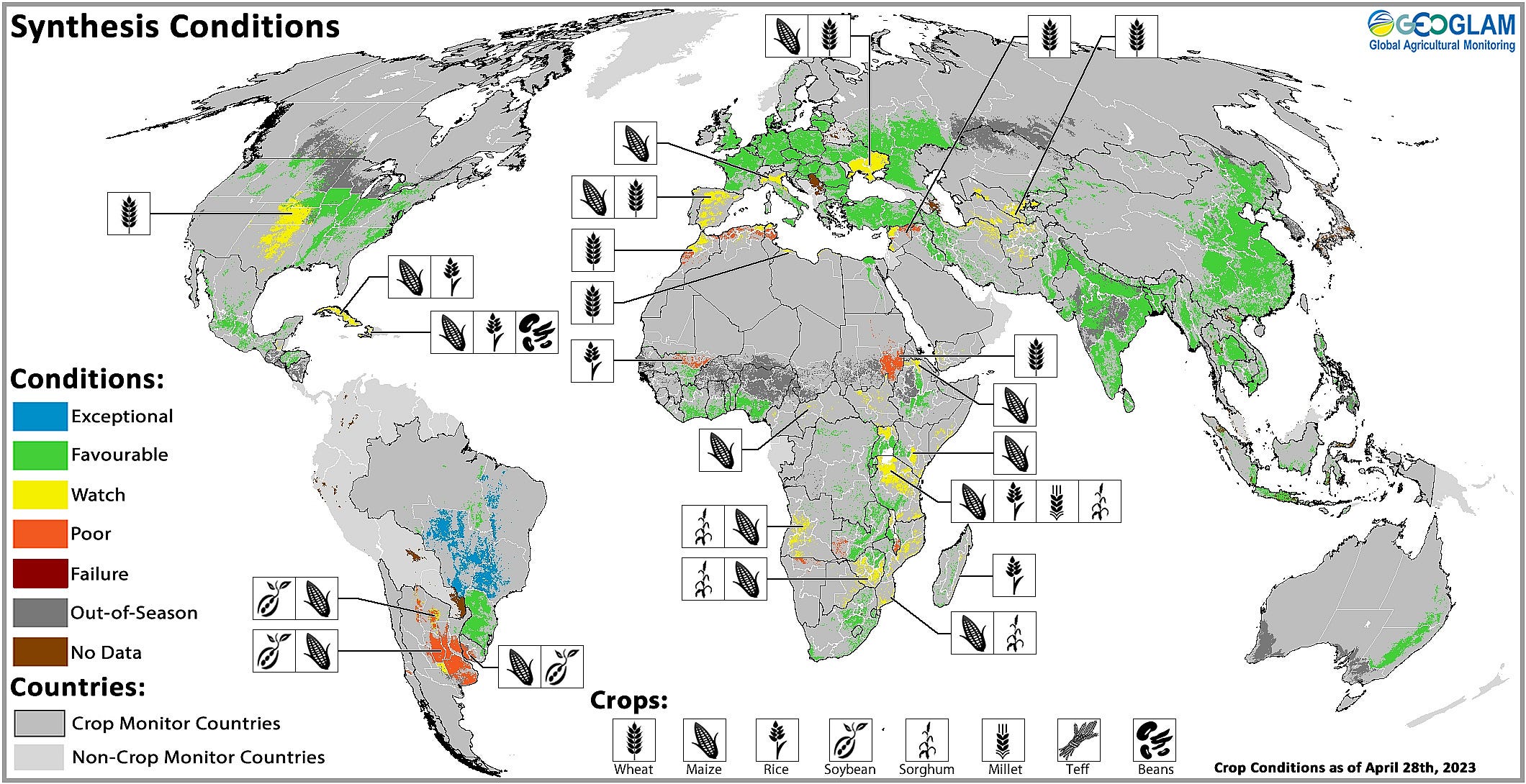
- The NASA Harvest consortium released the first up-to-date harmonized global crop type maps for five major commodity crops, combining over 20 data sources (for May 2023).
4. Click-Worthy Stuff: Check These Out 🔗
- This well-done investigative piece from the New York Times that uses satellite data to track down the movements of a Russian oil tank fleet that violated sanctions on crude oil;
- This week’s edition of Planet’s Snapshots that curates some beautiful images of geoparks (or locations that combine geological significance with sustainable tourism and science).

Subscribe for more Earth observation insights!
One Discussion Point
Analysis, thoughts, and insights on developments in EO
5. SAR wave vs hyperspectral wave in EO
We have seen quite a few investments into SAR and hyperspectral companies in the past couple of years and it seems to be continuing in 2023. Next week, I will include a summary of investments in EO for 2022, by sensor and by vertical - so you can see that for yourself. But, as I noted my very own EO technology hype cycle, SAR and hyperspectral are at the peak of inflated expectations.
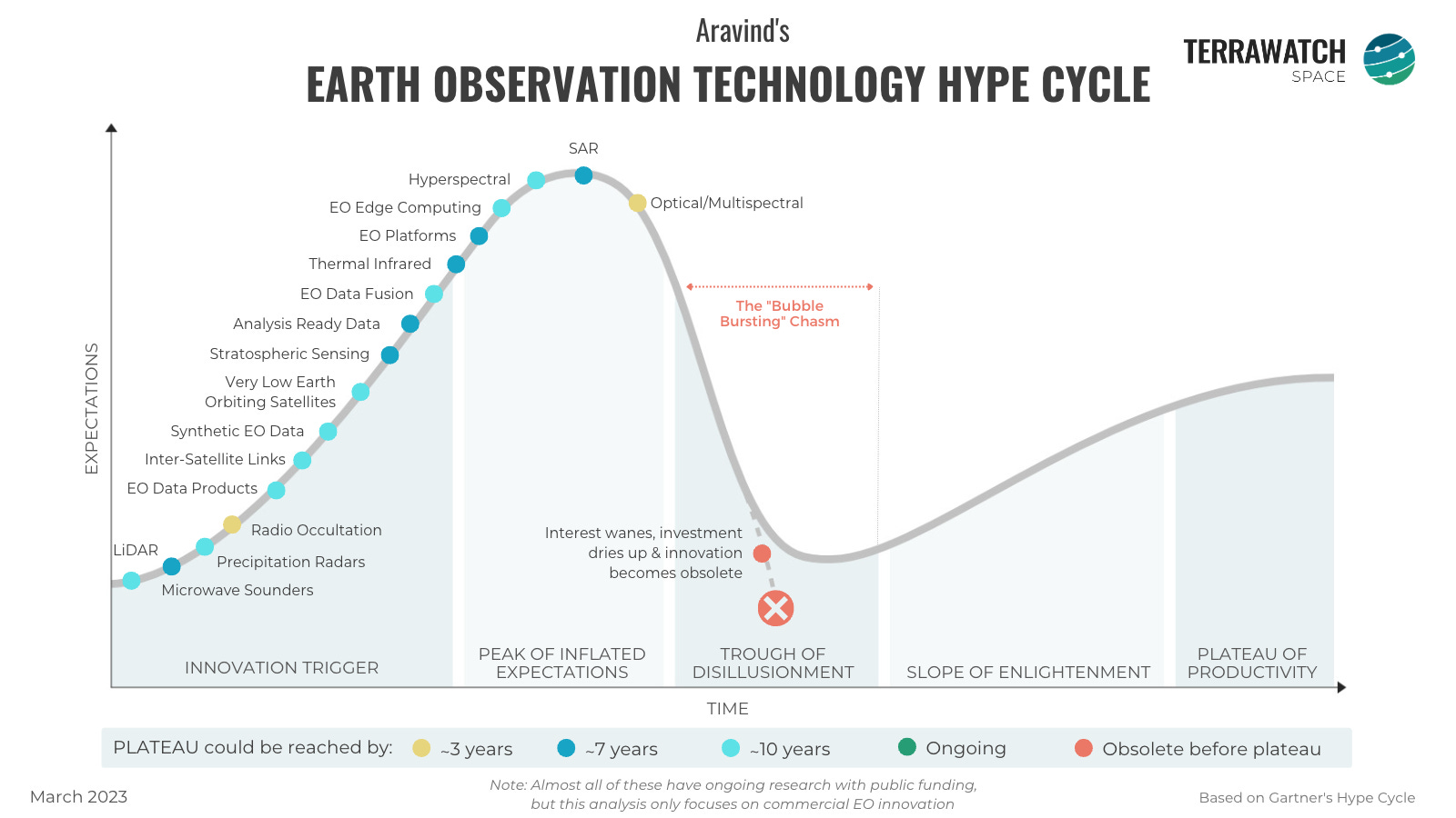
But one key difference between the ongoing SAR wave and hyperspectral wave in Earth observation: The distinct foundations that have been built over the years, for data processing and use case demonstration of the value derived from each sensor.
SAR was available as open data for several years now, primarily thanks to Sentinel-1 among others. Meaning some key foundational tools for preprocessing, processing and fusion of SAR data with other sources have been developed over the years.
Dozens of SAR analytics companies were able to leverage that and demonstrate critical use cases even before the arrival of data from the NewSpace commercial SAR satellite companies.
Au contraire, large-scale hyperspectral imagery from satellites has not been easily available. There have been some hyperspectral demonstration missions - EO-1, PROBA and more recently, PRISMA and EnMap. But, there have not been any satellites on the scale of Sentinels or Landsats, that could have led to the development of processing support tools for hyperspectral.
But the good news? Hyperspectral is not new - aerial, drone-based and other hyperspectral data has been in use in sectors including surveillance, biotech, medicine, and agriculture among others for decades. So, we already have some learnings and best practices on the use and adoption of hyperspectral data.
The bottom line? SAR EO companies somewhat have it easy, as the foundation have been there - basic tools were available and some use cases were already demonstrated. Hyperspectral EO companies have some work to do - the onus is on them to both build the tools and demonstrate the value add for end-users.
Scene from Space
One visual leveraging EO
This is a new section where I want to link an image or a video based on EO that is interesting or cool or informative (or all of the above), that caught my attention.
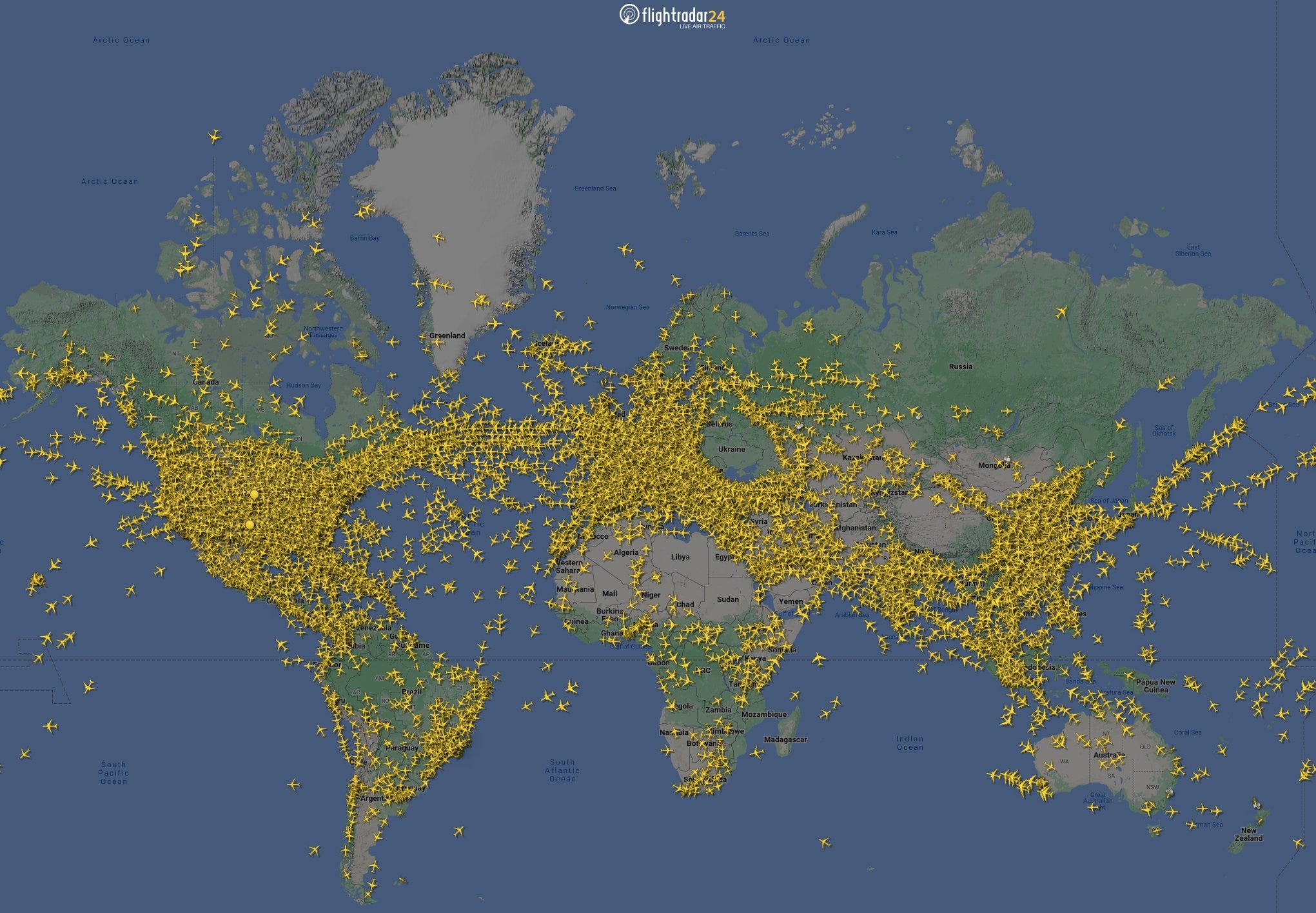
6. How much are we flying?
For this week, I found this interesting image from FlightRadar24, a Swedish company that provides real-time aircraft flight tracking information, leveraging data from navigation satellites, automatic dependent surveillance-broadcast (ADS-B) sensors and other sources.
The following image, posted on Twitter on May 26, shows 22,000 flights in the air at the same time, which the company claims is the most number of flights they have ever tracked at a single point in time. FlightRadar24 also claims that they tracked 253,000 flights on air on May 25 - another record. Just how much is too much flying?1
One Podcast Episode
From the TerraWatch Space podcast
7. Why Space Sustainability Matters for Earth Observation
We are launching more Earth observation satellites than ever before, and the progress in space tech has meant that any individual, organisation or country can put up an instrument in space to collect data for scientific, commercial, environmental or strategic purposes. But how sustainable is that?
To discuss this, I had Krystal Azelton, Director of Application Programs at the Secure World Foundation to discuss: the state of the space environment, the threats and worst-case scenarios, what regulations exist and how effective they are, the similarities with climate policies, why every stakeholder in the Earth observation sector should care about this topic and more.
Until next time,
Aravind.
In 2021 aviation accounted for over 2% of global energy-related CO2 emissions, having grown faster in recent decades than road, rail or shipping. ↩


