Welcome to another edition of ‘Last Week in Earth Observation’, containing a summary of major developments in EO from last week and some exclusive analysis and insights from TerraWatch.
In this edition: Advancements in weather forecasting, how to leverage multiple data sources for building EO solutions, tracking volcanic eruptions and more.
Four Curated Things
Major developments in EO from the past week
1. Contractual Stuff: Funding, Contracts and Deals 💰
Funding
Blackshark.ai, which is building an end-to-end geospatial platform, raised $15M in Series A extension from investors including notable ones such as Maxar, M12 (Microsoft’s Venture Fund), and Safran among others;
Along with this news, the company also released Orca Huntr, an AI-based tool for automated object identification on geospatial data;
Contracts
- UAE-based geospatial company Bayanat and satellite communications firm, Yahsat extended the contract with SAR satellite provider Iceye, to provide an additional two satellites for their EO programme, totalling up to seven.
2. Strategic Stuff: Partnerships and Announcements 📈
Partnerships
- Fairtrade International, a non-profit focused on sustainable agriculture is teaming up with Dutch startup Satelligence, for EO-based monitoring of farms of all certified cocoa- and coffee-producing organisations globally;
- EO data distributor SkyFi is partnering with Israeli startup ImiSight, a geospatial platform which will be integrated into SkyFi’s platform;
Announcements
- Weather intelligence company, Tomorrow.io announced the next iteration of its weather forecasting platform, integrating data from its recently launched precipitation radar satellites;
- Google’s DeepMind released an AI-based model that can deliver faster and more accurate weather forecasts than the gold-standard weather model from the European Centre for Medium-Range Weather Forecasts (ECMWF).
My take: We desperately need more R&D across the weather value chain in order to prepare for a future adaptation to the changing climate. As companies like Spire, Tomorrow.io and others launch satellites to collect proprietary data to improve weather forecasting, it is equally important that companies such as Google, Microsoft, Nvidia and Huawei along with agencies such as NOAA, Met Office and ECMWF are advancing AI-based modelling capabilities.
But, if you are going to think that AI models will replace traditional models, you are wrong. AI models still depend on the traditional models to supply training data and to generate the scenarios they use as a starting point to provide a forecast. We will see a complementary relationship developing.
3. Interesting Stuff: More News 🗞️
- Analysis of satellite imagery showed that the UAE, the host of the upcoming COP summit, is breaking its own ban on routine gas flaring, allowing the escape of some unburned methane gas into the atmosphere;
- China launched the first of a new series of Haiyang ocean observation satellites, equipped with an X-band SAR payload;
- The latest National Climate Assessment for the US was published which highlighted how the impacts of climate change are felt across the country;
- Analysis from the Copernicus Climate Change Service showed that 2023 is on track to become the warmest year after a record October.
4. Click-Worthy Stuff: Check These Out 🔗
This piece that looks into the ongoing investment frenzy for EO companies (including some comments from yours truly);
This article from the Financial Times, which includes an analysis of Sentinel-1 imagery to conduct building damage assessments in Gaza;
This analysis from the New York Times, which includes a combination of AIS data from Spire and high-resolution imagery from Planet and Maxar showing how China is dominating the South China Sea region;
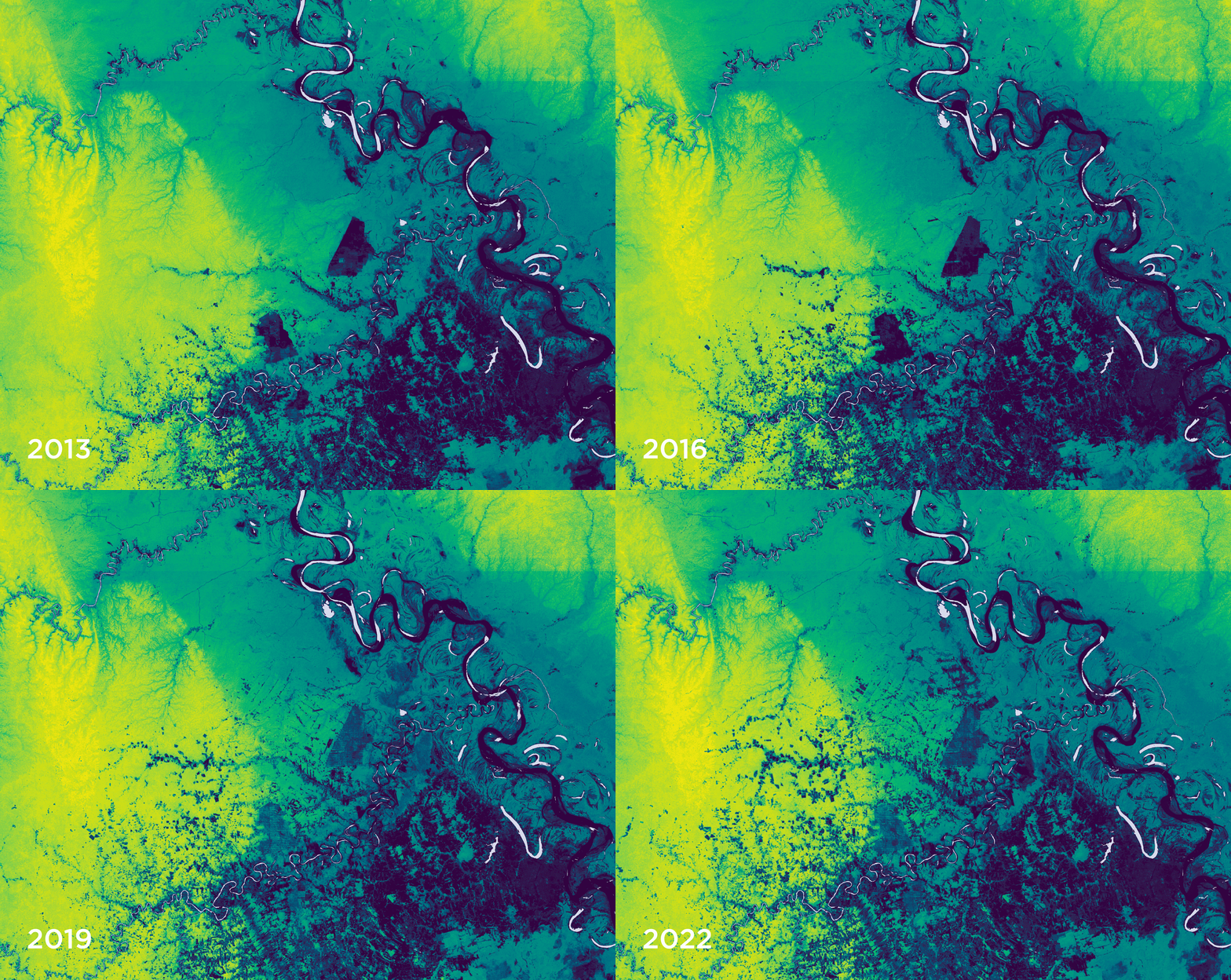
The latest edition of Planet’s Snapshots newsletter, which focused on forest carbon, coinciding with the company’s release of the Forest Carbon Diligence product, for mapping aboveground forest carbon globally.
The animation below from Planet shows the evolution of forest carbon in Pucallpa, Peru between 2013 and 2022.
If this was forwarded to you, please subscribe to receive Earth observation insights!
One EO Discussion Point
Exclusive analysis and insights from TerraWatch
5. Leveraging Multiple Data Sources for EO Solutions
Applications developed using EO generally depend on more than one data source. Data can be acquired from multiple sensors in orbit from different EO data providers as well as from other sources such as stratospheric balloons, aircraft, drones and ground sensors. As such, the final solution that provides the much-needed insights to the end-users is more often derived from a combination of different data sources.
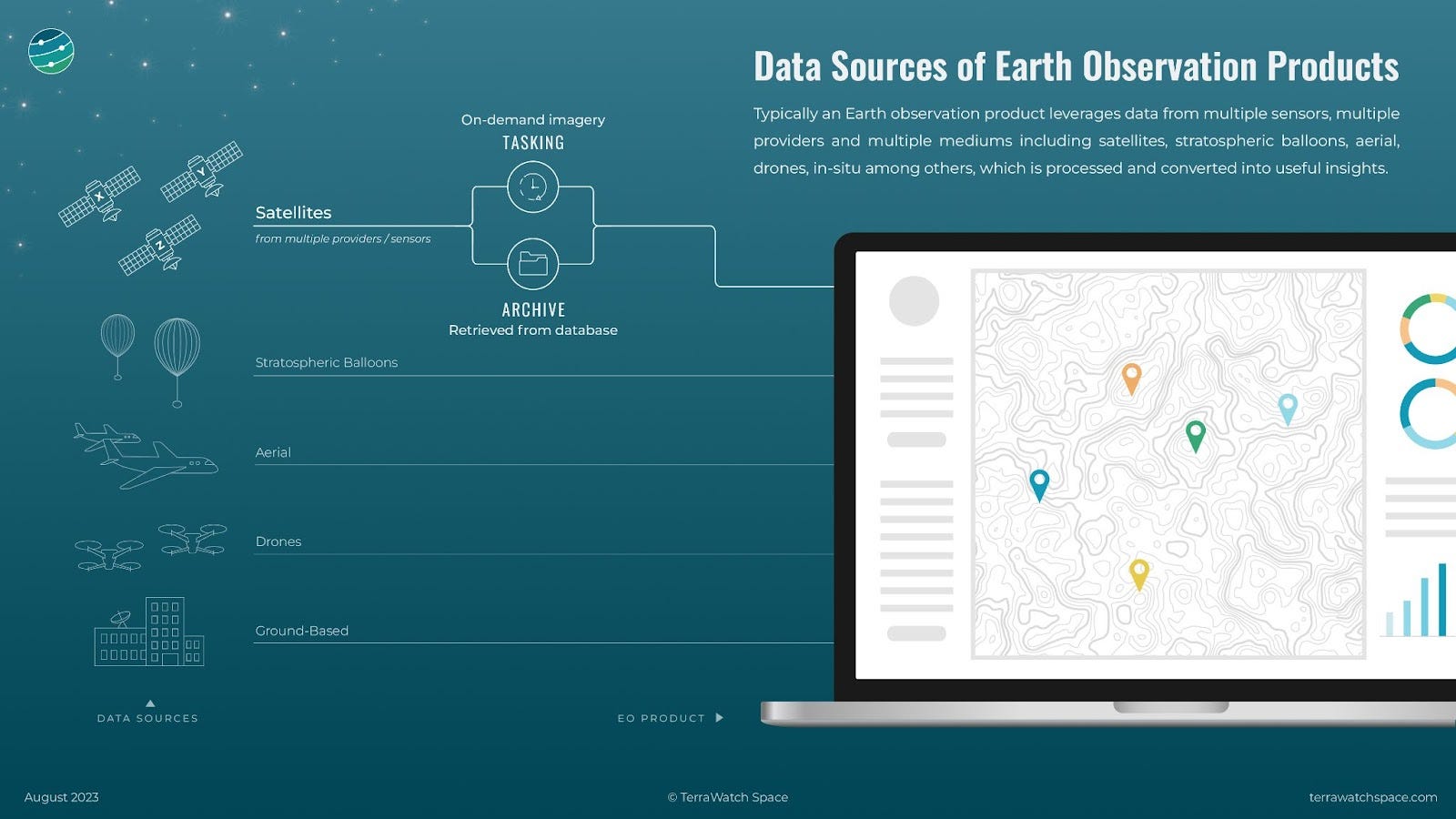
Depending on the use case, there are several reasons for depending on more than one data source. In the initial demonstration phase, where an application is being developed, historical satellite imagery, called archived data, might be required to conduct a time-series analysis of the area of interest. At this stage, training data for machine learning models might be required, whereas data from other sources such as balloons, aircraft and drones might also be required. Typically, this data is of higher spatial resolution and hence, helps improve the machine learning algorithm to identify objects and detect patterns.
As the application development progresses, more up-to-date data might be required for real-time monitoring of the area of interest. This is where on-demand imagery, called tasked data, becomes relevant allowing the application developer to capture an image or a series of images of the area of interest on a given date or specific timeframes in the future. This tasked data when fused with existing data points enables automated real-time monitoring through EO.
There are several distributors of EO data, called EO marketplaces or EO platforms that facilitate the development of EO applications from different sources. Check out this piece, written in collaboration with UP42, an EO platform provider, on how they enable users of EO to access multiple data sources.
Scene from Space
One visual leveraging EO
6. Tracking Volcanic Eruptions
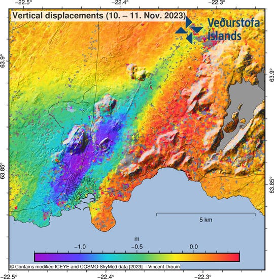
You might have seen that the town of Grindavik is on high alert as they wait to see whether a volcano rumbling under the Reykjanes peninsula will erupt.
Analysis of SAR data from the Iceye and COSMO-SkyMed satellites has shown that there has been subsidence (sinking) in and north of Grindavik, with more than 1 meter in some places. See the following image for reference - blue and purple areas indicate vertical sinking of around 1m.
If you want to know more about why and how this phenomenon occurs, check out this thread.
ICYMI - EO Summit Launched
Last week, I announced the official launch of the first-ever edition of EO Summit, a conference to bring the EO industry and end-users together, focused on commercial, enterprise and climate-related applications of EO.
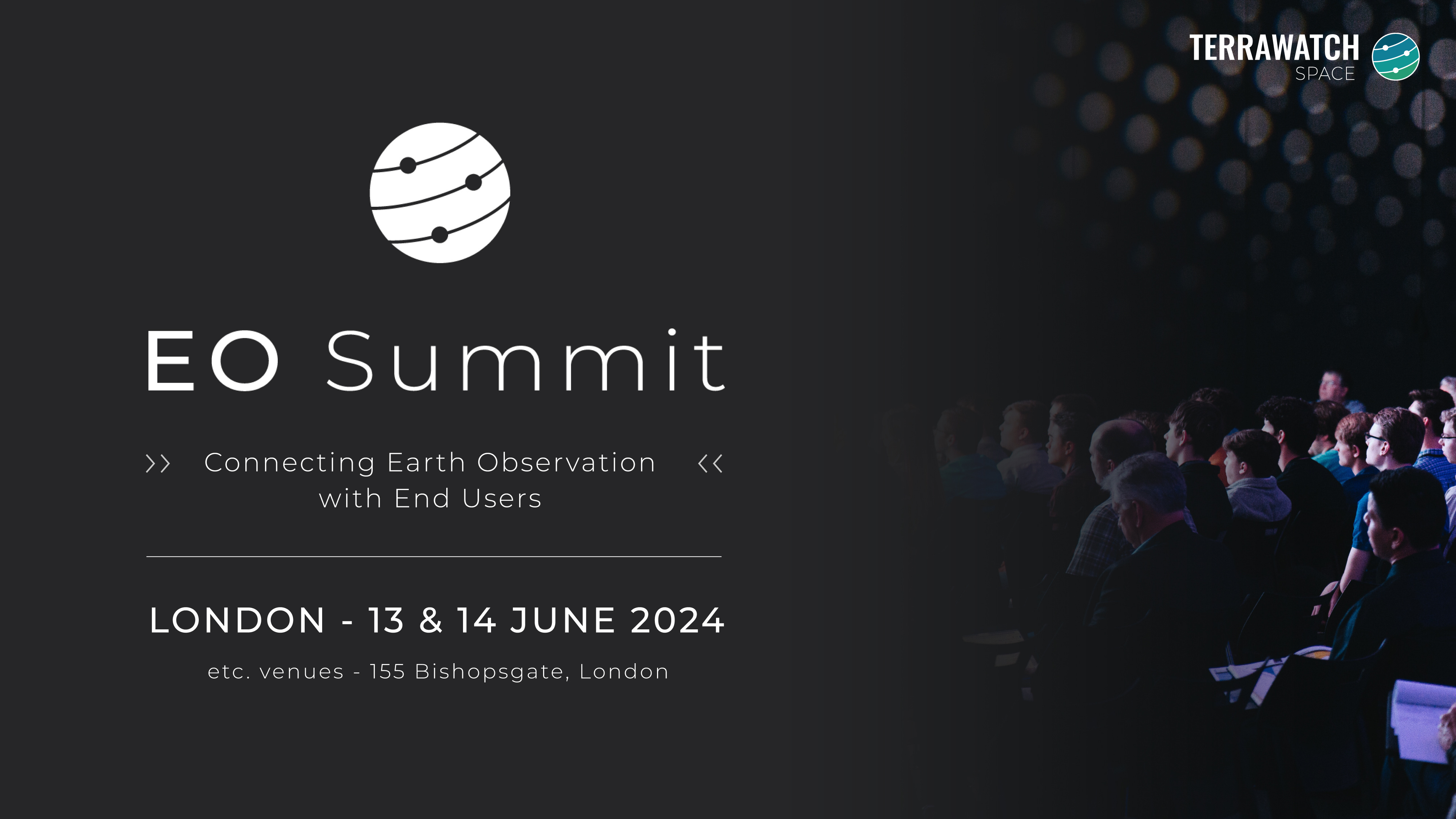
Have you blocked the dates on your calendars yet? Some of you wanted some more information before you can - so here you go.
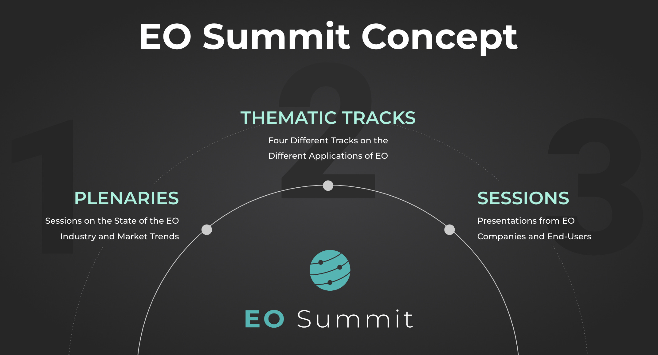
The figure below gives you some more information about EO Summit and what will take place during the event. More information, including the official website and how to purchase early-bird tickets, will be released in the next couple of weeks.
If you are interested in sponsoring the event, reply to this email or get in touch.
PS. Yes, this conference is going to be held in London, but this is NOT a UK-focused event. The aim is to bring together the GLOBAL Earth observation sector and the end-users of EO across different verticals, from around the world. The plan is to hold the event in a different location every year.
Until next time,
Aravind


