

Happy September, everyone! Welcome to a new edition of ‘Last Week in Earth Observation’, containing a summary of major developments in EO from last week and some exclusive analysis and insights from TerraWatch.
In this edition: Backward vertical integration, running code in space, edge computing for Earth observation and hurricane traffic jam
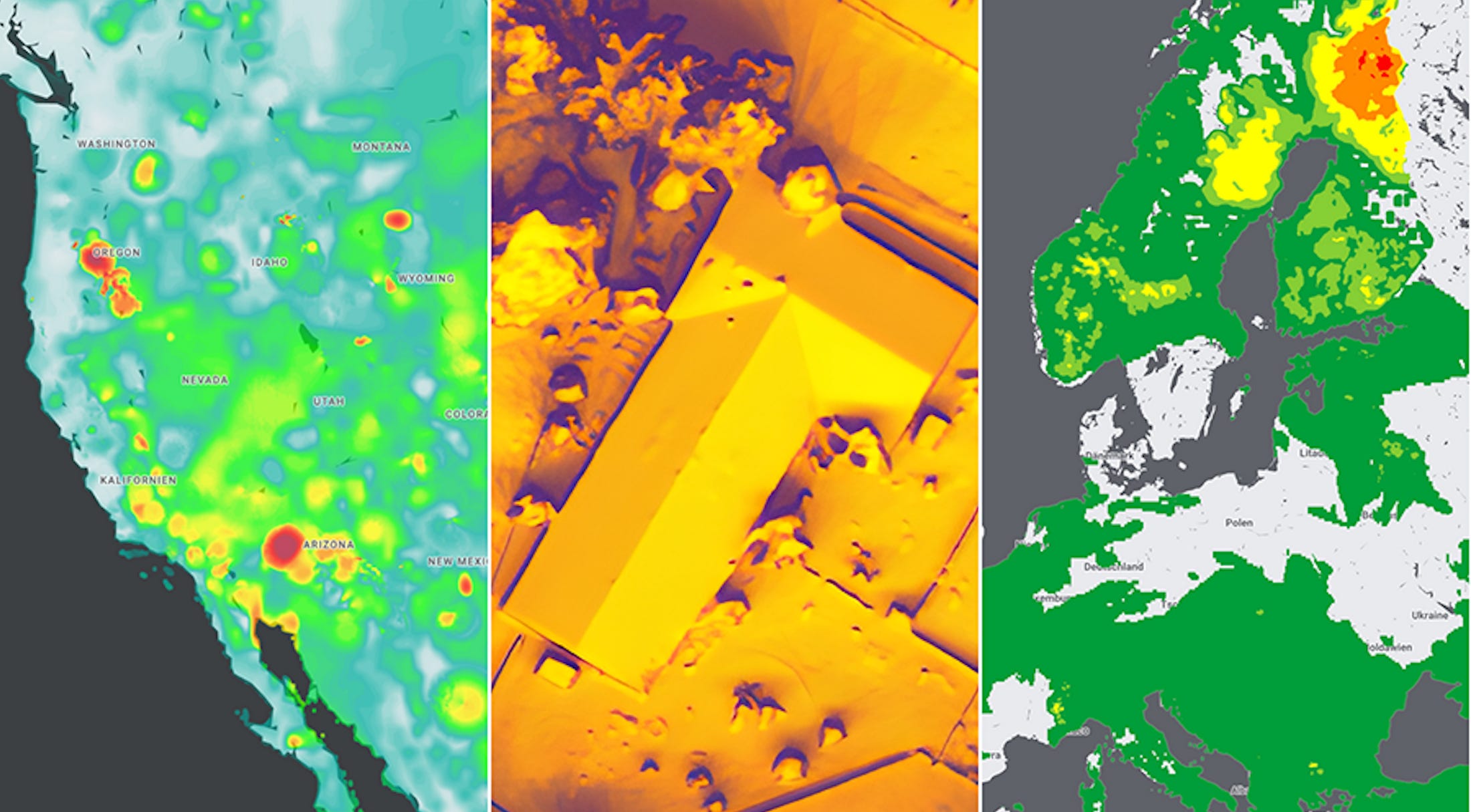
Four Curated Things
Major developments in EO from the past week
1. Contractual Stuff: Funding, Contracts and Deals 💰
- Ball Aerospace, Northrop Grumman, Orbital Micro Systems and Spire were awarded study contracts worth roughly $5M each by NASA to design microwave sounders for the Near-Earth Orbit Network program;
- Spire conducted a reverse stock split to boost its share price, in order to increase the price of an individual share and get above the $1 threshold set by the New York Stock Exchange to avoid delisting;
- Indian EO startup SatSure raised $15M in a Series A round, following strategic investments top private sector Indian banks announced earlier this year, to launch four high-resolution optical & multispectral satellites.
My take: SatSure is one of the few Earth observation companies that follows a backward vertical integration strategy, transitioning from an EO analytics firm to an EO satellite firm.
As is the case with the handful of companies in this category1, they are launching satellites based on a commercially-focused, problem-driven approach with validated user needs, as opposed to traditional EO companies that typically have a technology-focused approach, with assumed user needs.
2. Strategic Stuff: Partnerships and Announcements 📈
- EO synthetic data Synthetaic has entered into a five-year strategic partnership agreement with Microsoft, which will provide access to cloud compute resources via Azure;
- Australian EO edge computing startup Spiral Blue unveiled a ‘Code in Space’ initiative to allow developers and researchers to run their custom code on its space edge computer, onboard a Satellogic satellite (more on this, below);
- Weather risk startup Reask announced a partnership with geospatial insurance-focused platform Geosite to offer risk forecasting solutions;
- Weather intelligence company Tomorrow.io released data from their recently launched weather radar satellites, which will now be integrated into their forecasting models;
- Indian EO startup, GalexEye Space, which plans to launch a multi-sensor satellite constellation, unveiled a drone-based SAR instrument capable of high-resolution imaging;
- Following the $225M acquisition of Breezometer last year, Google launched a set of environmental APIs for Solar, Air Quality, and Pollen, which use data from satellites combined with other data sources.
3. Interesting Stuff: More News 🗞️
- China launched three more EO satellites, part of the Yaogan constellation of military reconnaissance satellites;
- Australia’s rapid bushfire detection capabilities using satellites have hit a roadblock, due to a lack of funding.
4. Click-Worthy Stuff: Check These Out 🔗
- This episode of the Minds Behind Maps podcast, where I was the guest to discuss the Earth observation market and building TerraWatch Space.
- This piece that looks into how satellites are being used by farmers in the agriculture sector, specifically in the winegrowing segment;
- This set of training courses from the UN (in partnership with various space agencies) on using space technologies for climate action.
Subscriber for more Earth observation insights!
One Discussion Point
Analysis, thoughts, and insights on developments in EO
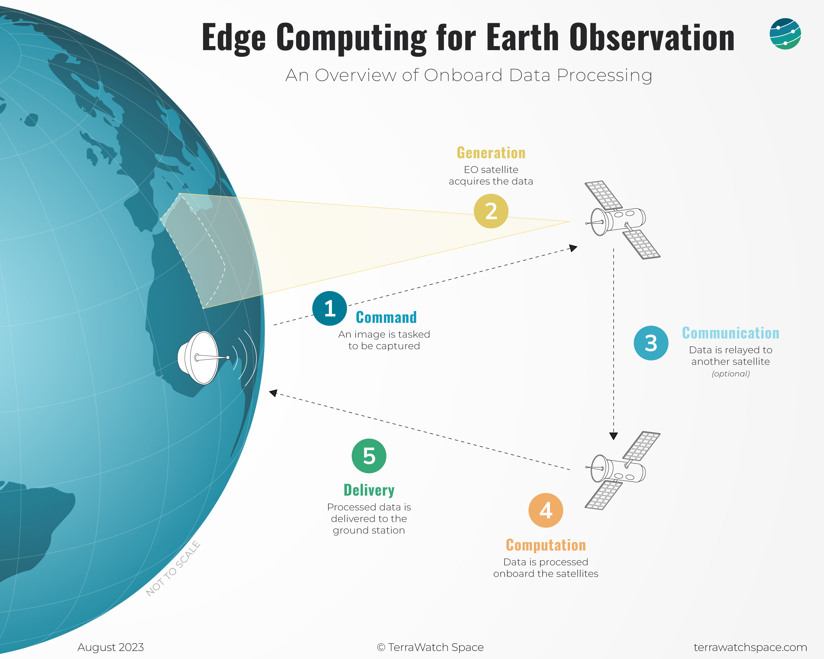
5. Edge Computing for Earth Observation
Edge computing means having the ability to process data closer to where it’s being generated, enabling processing at greater speeds and volumes, leading to greater action-led results in real-time. I first got exposed to edge computing in EO when ESA announced the PhiSat mission in 2019, the first satellite to demonstrate using AI to process EO data in orbit. The mission showed the potential of AI as a tool for cloud detection onboard a hyperspectral imager.
Commercial Earth observation satellites of the past and present focused on data availability, based on assumed user needs. My thesis is that the commercial EO satellites of the future will focus on latency and usability, based on validated user needs. And, the two technologies that will enable this evolution will be edge computing (or onboard processing) and inter-satellite links (or data relays).
Latency, as in, how quickly they need the information delivered from space to the ground. Usability, as in, in what form they need the information (raw data vs. analysis-ready data vs. readymade analytics).
In the latest deep dive for the paid subscribers of the newsletter, I wrote about Edge Computing for EO including the process of edge computing, its potential for EO, the commercial landscape, and the so-what. The figure below shows a simplified overview of the process of edge computing in EO.
Become a paid subscriber to read the full essay (20% off until this Friday).
Scene from Space
One visual leveraging EO
6. Traffic Jam in the North Atlantic
Last week was quite eventful over the Atlantic Ocean with four tropical cyclones - Idalia, Franklin, Gert and Jose. The image below from a NOAA satellite shows all the tropical cyclones clustered together, but not interacting.
In case you are wondering, yes, hurricanes can interact and merge together. This phenomenon called the Fujiwhara Effect, is when two hurricanes pass close by each other spinning in the same direction. Usually, the stronger hurricane will absorb the other one. If the storms are of similar strength, they will be pulled to each other, spin around each other and then go on their own paths.
In this case, tropical storm Jose (the smallest one on the right) was absorbed by its stronger counterpart Franklin (the second largest one in the middle), which has now weakened and poses no threat to land. However, Hurricane Idalia (the one on the left) dumped heavy rains and unleashed strong winds causing damage to lives and property in Florida, Georgia and South Carolina.

PS. Conference season starts in September. I will be attending quite a few of them over the next few months. Send me a note, if you want to meet up. Here are a couple I will be going to this month:
- EUMETSAT Meteorological Satellite Conference - September 11
- World Satellite Business Week - September 13 - 15
Until next time,
Aravind.
Tomorrow.io, MyRadar, EarthDaily Analytics and EOS Data Analytics are a few other examples in this category. ↩


