


Welcome to a new edition of Earth Observation Essentials, the free biweekly newsletter from TerraWatch covering key highlights from the EO market along with exclusive insights and analysis.
If you would like a more detailed, comprehensive market briefing with exclusive analysis, delivered every week, become a Pro subscriber, or a Premium subscriber, for more deep dives on EO markets, technologies and applications.
📈 EO Market Highlights
Major developments in EO
- Planet won a German federal contract worth up to €25M over five years, giving civil authorities exclusive tasking access to a dedicated high-resolution satellite constellation, analytics and a Europe-hosted data platform. Coordinated by Germany’s federal mapping agency, it is Planet’s first deal for its dedicated constellation offering with a civil government.
- Thermal EO company Hydrosat unveiled Osiris, its next-gen constellation providing 25 m thermal imagery across a very wide 160–340 km swath and 10 m multispectral data, targeting daily monitoring for water, agriculture, infrastructure and national security.
While everyone likes to talk about winners in a specific category, I think the thermal market may prove large enough for all three to find a place rather than converge around a one thermal winner.
- ESA awarded parallel studies to ICEYE and Leonardo to design the EU’s future Earth Observation Governmental Service, a planned sovereign EO system for security and crisis response starting from 2028. The studies will define the full architecture, including satellites, ground systems, processing, distribution and how commercial and national capabilities could be integrated.
- ESA and French AI company Mistral signed a strategic agreement to expand the use of AI across space activities, including EO. The work will build on projects such as EVE, ESA’s AI assistant for EO, as well as explore sovereign AI infrastructure for processing EO data.
- NOAA announced three weather satellite data buy contracts totaling $67M for two years which includes $33M for Spire and $28M for PlanetiQ – both providing radio occultation data profiles as well as $5M to Ethereal Space for ionospheric data for space weather applications.
While this is a huge milestone for weather satellite companies, this creates a sort of dilemma for the companies due to the global weather data sharing policy.
In a recent edition of the Pro newsletter, I analysed why the new NOAA contracts and the $2.35B contract vehicle are a big deal and explain how weather remains a pretty unique market.
Upgrade to a Pro subscription for just $75 per year to check out the analysis and receive weekly exclusive market briefings.
💡 Insight Bytes
A quick dose of analysis from TerraWatch
What are EO Foundation Models and Embeddings? Why do they matter?
An EO Foundation Model (EOFM) is pre-trained on large volumes of satellite data so that it learns general patterns that can be reused across different tasks. The important shift from traditional machine learning approaches where a model is typically built around one specific problem, and sometimes even one geography.
The following visual uses Lego blocks as an analogy to explain how EOFMs work.
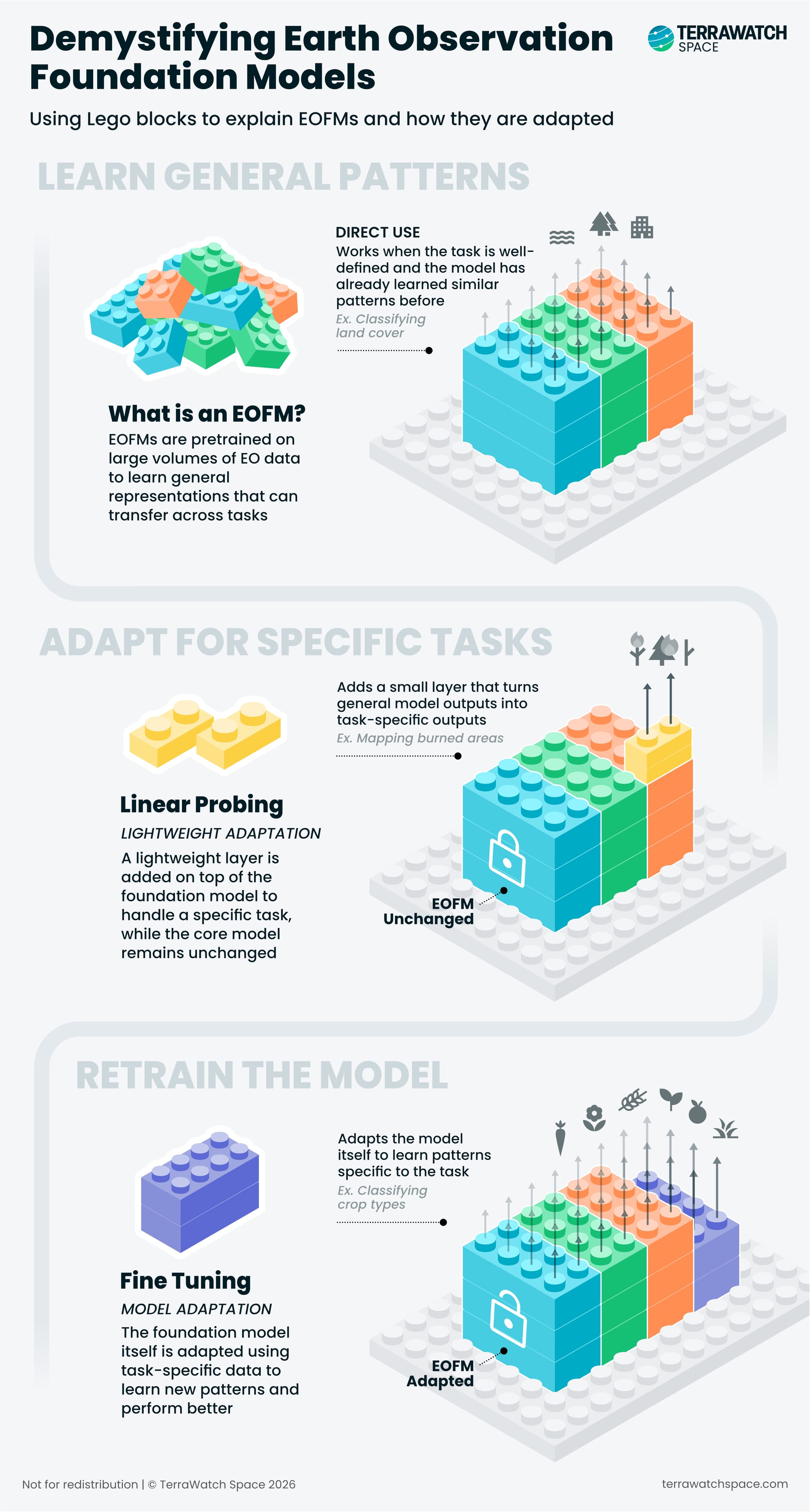
The visual above shows the different ways the knowledge learned during the training phase can be applied to a new task. Some tasks may need almost no adaptation, while others may require substantial fine-tuning and additional training data.
EOFMs are also not one homogeneous category – some are trained only on optical imagery, while others combine optical, SAR or other sensors. Some EOFMs are designed to capture how a place changes over time, while some also connect imagery with text, allowing you to go ask questions in natural language like "find all construction sites like this one."
Where Embeddings Fit In
EOFMs can turn satellite imagery into embeddings: numerical representations that capture the features and patterns the model learned from the data. Similar features tend to produce similar embeddings (codes), which makes them useful for search, comparison and downstream analysis.
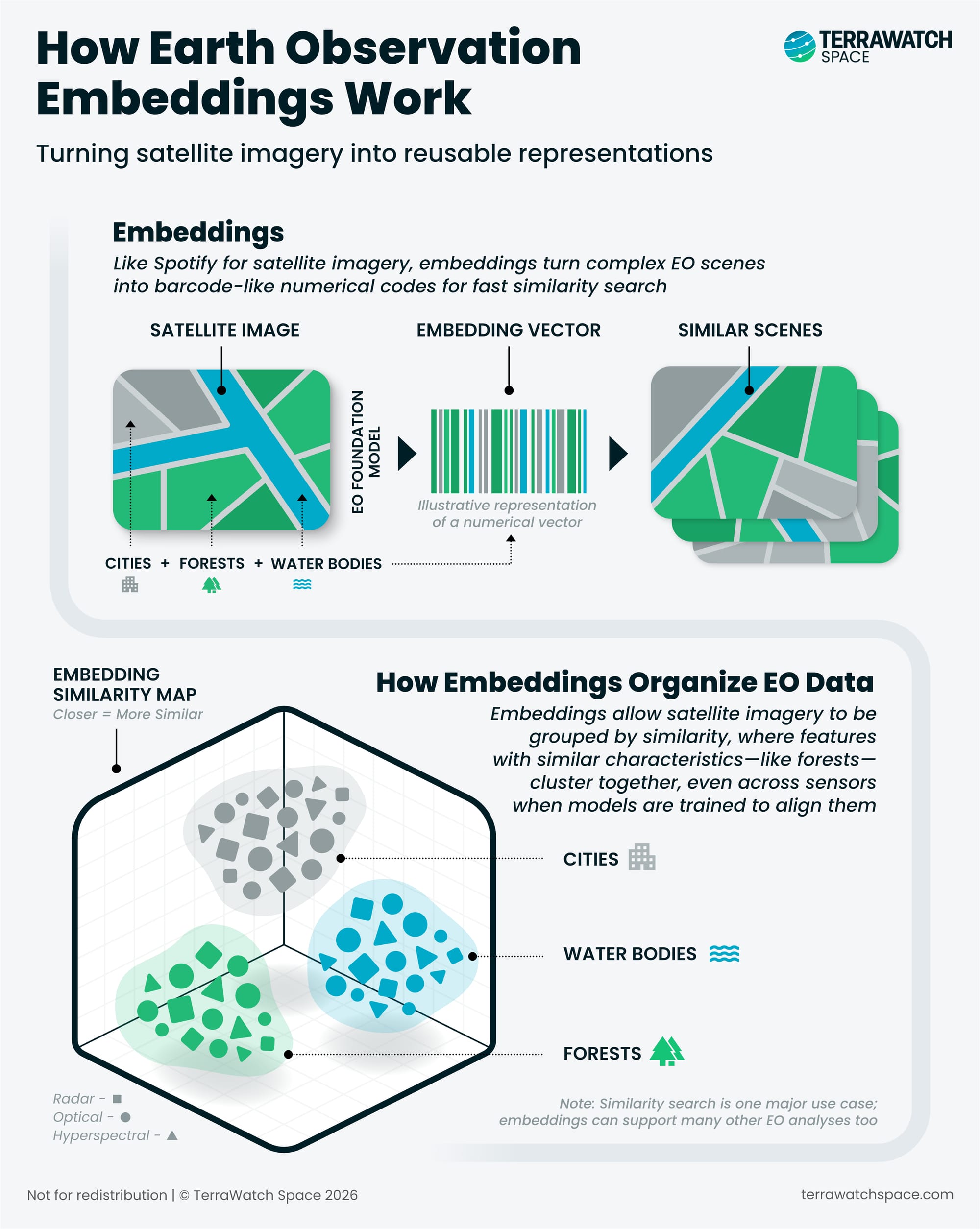
This also means the model itself does not necessarily have to reach the user. An organisation can run an EOFM once across a very large archive and distribute the resulting embeddings instead. This is what Google released with their big announcement of AlphaEarth Foundations embeddings last year. The user gets access to the model’s representations of the imagery without needing to run, host or even access the underlying model.
What makes embeddings interesting is that they have now created a new potential abstraction layer in EO. Embeddings are products in their own right, rather than simply an intermediate output inside an AI pipeline.
It also creates an important dependency: embeddings are not neutral representations of the Earth. What they contain depends on the model that produced them, the data it was trained on and the patterns it was designed to preserve. In practice, this means embeddings produced by two different EOFMs likely cannot be compared or combined, unless by design.
Agents, the other buzzwords doing the rounds, sit on top of all this. They can use an EOFM or leverage existing embeddings, but they can also work with conventional models, GIS tools and imagery catalogues, and none of the above needs an agent to be useful. I plan to cover geospatial agents in a separate deep-dive in the coming months, but you can check out Planet's Agentic AI, in the meantime.
Once EOFMs and embeddings become reusable building blocks of EO, they start changing the economics of EO. Who builds the models, what data they have access to, what gets commercialised (and how), and overall, where the value and moats in EO are going to shift to.
Our latest Deep Dive looks at how EOFMs will reshape the EO market. Become a Premium subscriber to read the full piece to learn more about who is building the models, how they are commercialised, and what they mean for the EO market.
🔍 Recommended Reads
Interesting links to check out
- CNN conducted an investigation on how 14 Russian spy satellites moved over a US military base in Saudi Arabia two days before a devastating attack by Iran – the video shows how fusion of data from different instruments work together.
- A new analysis using data from Carbon Mapper/Planet satellites ranked the major oil and gas methane super-emitters in the US – the study showed only about a third of detected plumes could be confidently tied to a specific operator
- Planet launched Amazon.ia, an Amazon-focused biodiversity monitoring initiative leveraging over 20 partners to combine satellite imagery with ground sensors such as acoustic recorders, camera traps and environmental DNA, to track ecosystem change at scale.
🛰️ Scene from Space
One visual leveraging EO
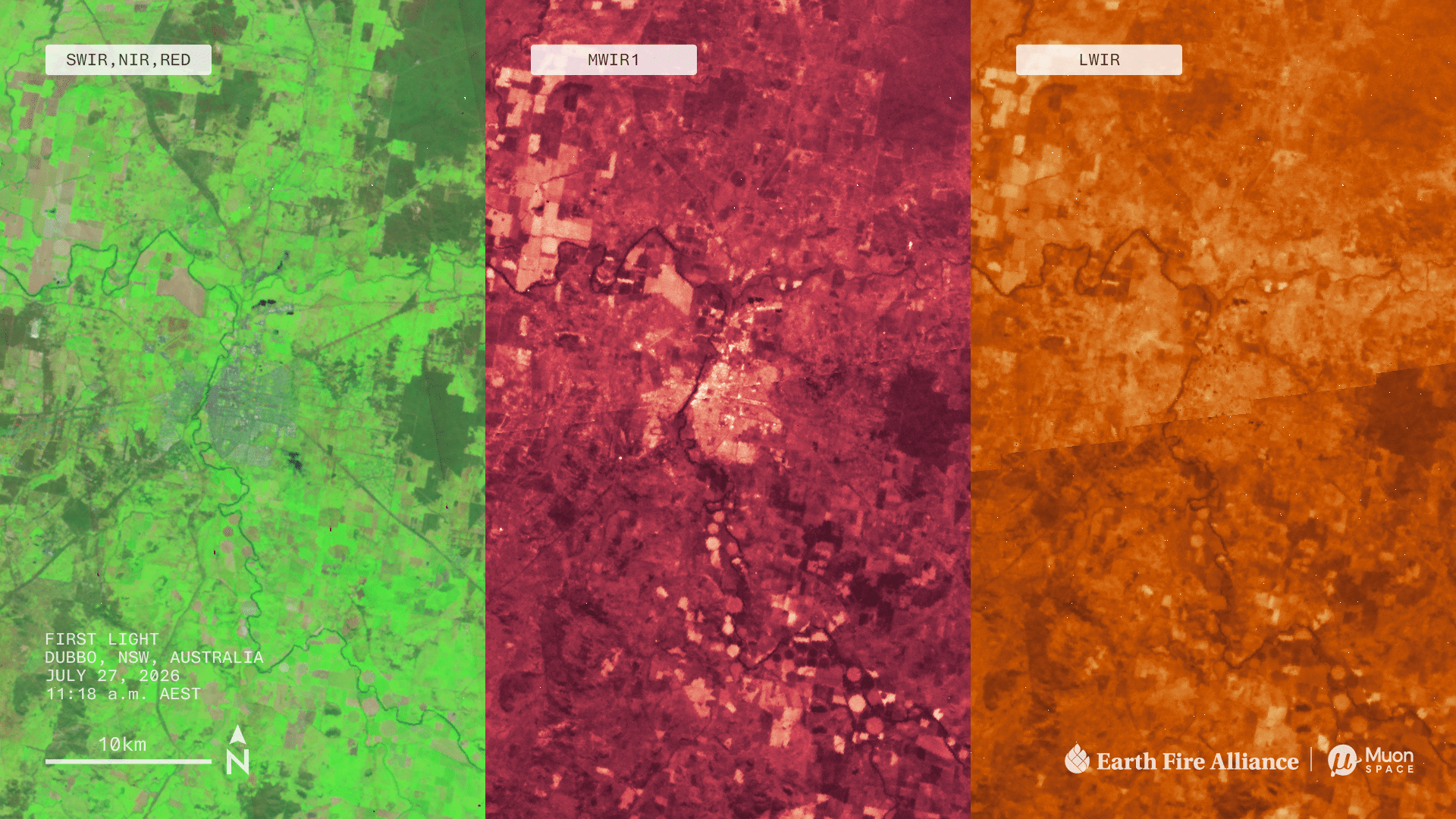
First Images from Purpose-Built Wildfire Monitoring Satellites
Earth Fire Alliance (EFA) and Muon Space released first light imagery from its first operational FireSat satellites, showing views of active fire.
FireSat is a unique constellation as it was purpose-built by specifically for early fire detection, detailed resolution, and rapid revisit, delivers both precision and cadence.
Currently funded by philanthropy, the model is an interesting case study of the dual-use nature of EO – the same systems built for EFA is also part of Muon's wider go-to-market strategy in EO, mainly towards government customers.
Until next time,
Aravind.


